

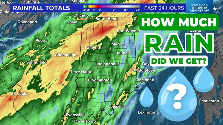
INDIANA, USA — After Hurricane Beryl made landfall near Matagorda, Texas as a category 1 storm with max sustained winds of 80 mph, it quick-moved north toward the Ohio River Valley with heavy rain and some tornado threats. Now, the storm has left Indiana, and the rainfall reports are in. How much rain did we get?
Tap HERE to track the rain leaving with our interactive radar.
(Scroll down for exact rainfall amounts from across Indiana.)
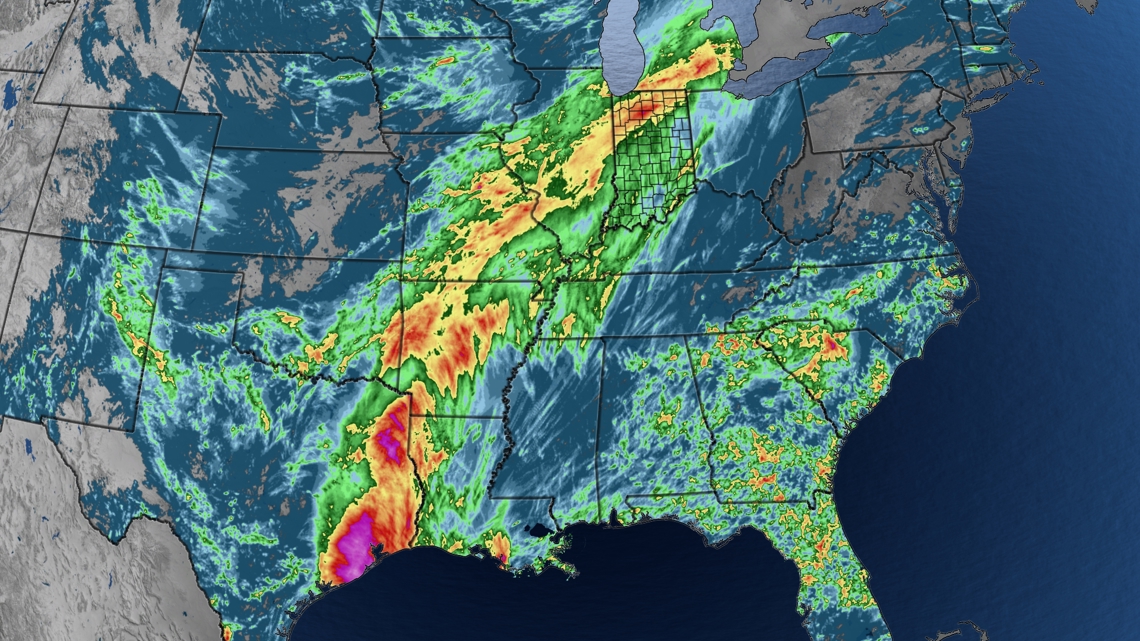
We have map of the accumulated rainfall from Beryl, which is the streak of brighter colors from Texas to Arkansas to Indiana. The yellow areas show locations that picked up at least 2 inches. In the red areas, we picked up 4-6". Outside of Texas, the two states that picked up the highest rainfall totals were Arkansas and Indiana — especially northern Indiana.

Rainfall totals from across the state
These totals are from Monday midday through Wednesday midday. We have listed many medium to large cities across Indiana. There are a few reports in rural areas that also picked up 4-5 inches, especially in north-central Indiana.
(ranked from highest to lowest)
- Rochester: 4.05"
- Elkhart: 3.73"
- South Bend: 3.07"
- Richmond: 2.61"
- Lafayette: 2.56"
- Brookville: 2.04"
- Carmel: 1.81"
- Kokomo: 1.74"
- Valparaiso: 1.60"
- Greenwood: 1.44"
- Jeffersonville: 1.43"
- Zionsville: 1.35"
- Indianapolis: 1.29"
- Terre Haute: 1.23"
- Evansville: 1.22"
- Columbus: 1.16"
- Fishers: 1.10"
- Crawfordsville: 1.08"
- Fort Wayne: 1.07"
- Shelbyville: 0.98"
- Bloomington: 0.97"
- Greenfield: 0.96"
- Vincennes: 0.85"
- Seymour: 0.74"
- New Castle: 0.61"
- Muncie: 0.59"

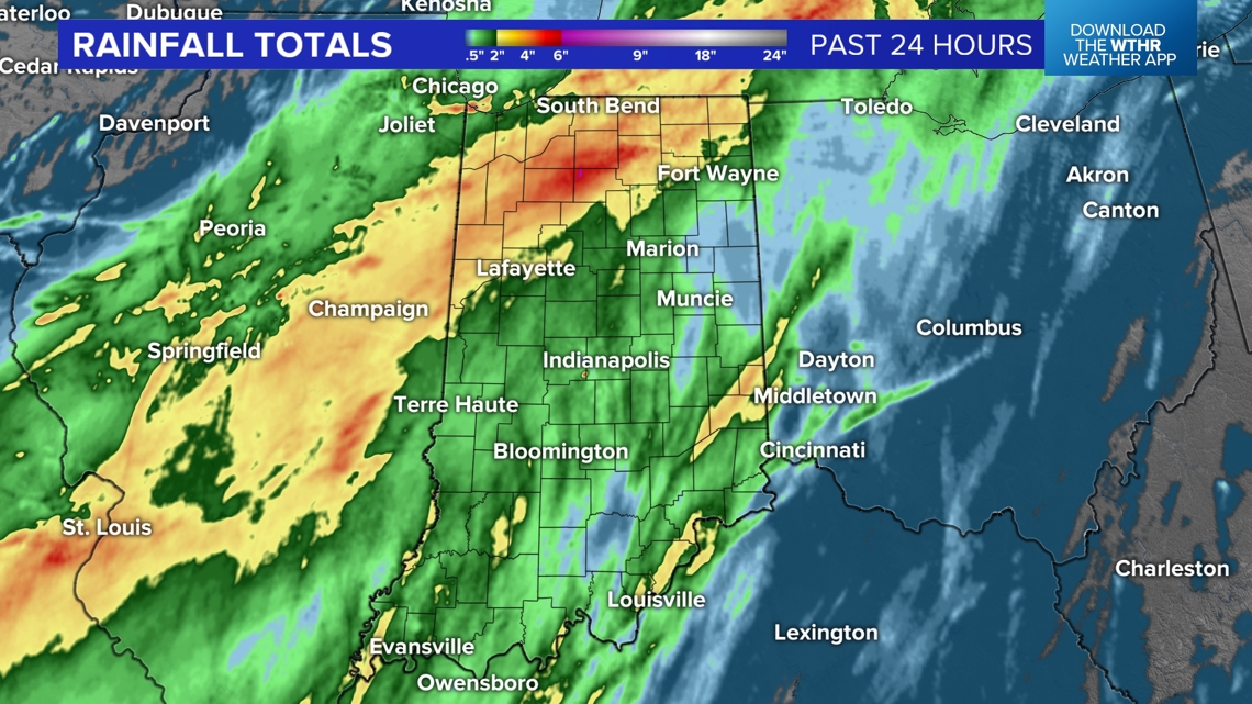
Much of the state picked up between 0.5 inches to 1.5 inches of rainfall. Rain lingered the longest on the northwest side of the low pressure, which helped northwestern and north-central Indiana to pick up a few inches.
Outside of this rain band, there were a few locations that also picked up heavy rain from individual storm cells. The Brookville Lake area had two storm cells – one after another – around 7-10 p.m. that brought a couple extra inches of rain.
What about severe reports and tornadoes?
We had a tornado touch down in the Mt. Vernon area in southwestern Indiana.
Most storms were rotating, and many had wall clouds; however, most storms were not able to produce a tornado that touched the ground.

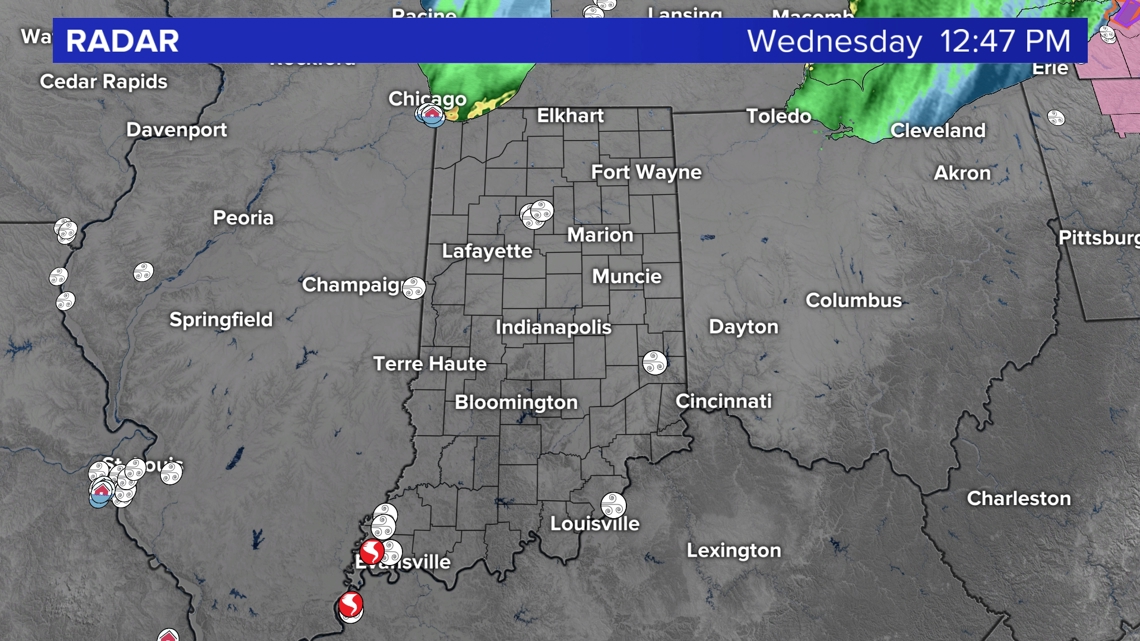
Some storms had some wind damage across the state (white circles).
Looking ahead
For the next couple days, a few spotty showers are possible in the afternoons. Most of the time will be dry as temperatures heat up into the weekend.
