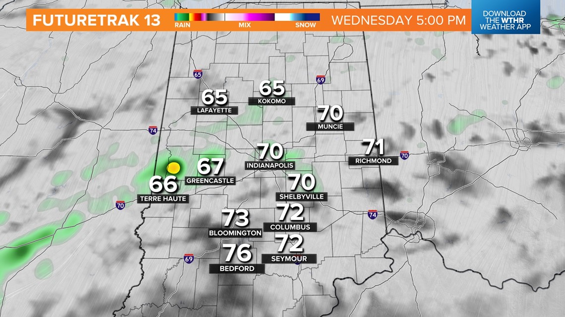
INDIANAPOLIS — Our forecast is playing out mostly as expected. The main axis of rain remains west-northwest of the Indy metro area, with rain more likely today from Veedersburg-Lafayette-Kokomo.
This doesn't mean there won't be sporadic sprinkles and showers farther east-southeast, but clouds generally have more bark than bite along/south of I-74 and I-69. This is also an area where we believe temperatures reach the mid-to-upper 70s with some localized 80°+ readings before sunset.
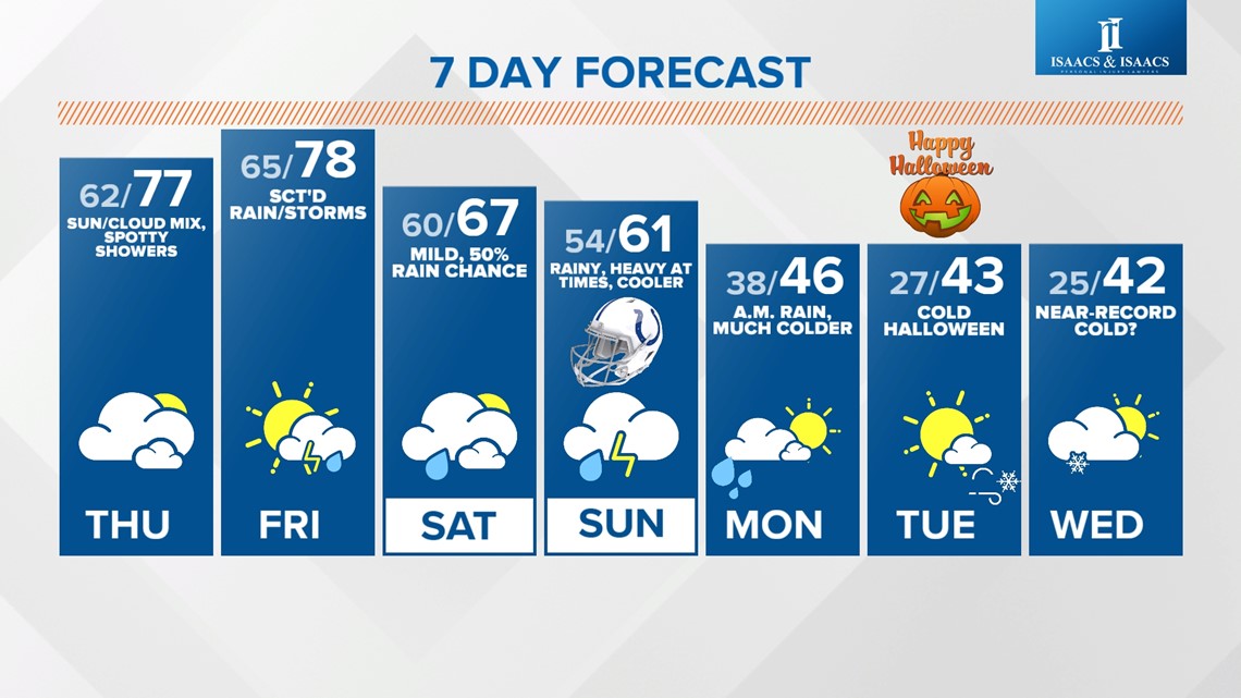
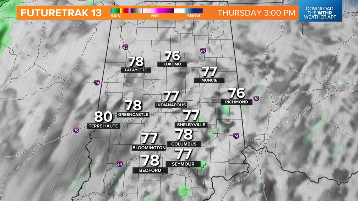
Thursday will be similar to today with the exception of even less coverage on radar. Balmy morning lows in the 60s warm into the mid-to-upper 70s with a mix of sunshine and clouds. Central Indiana remains on the warmer side of an approaching cold front Friday when highs make a charge at hitting 80°.


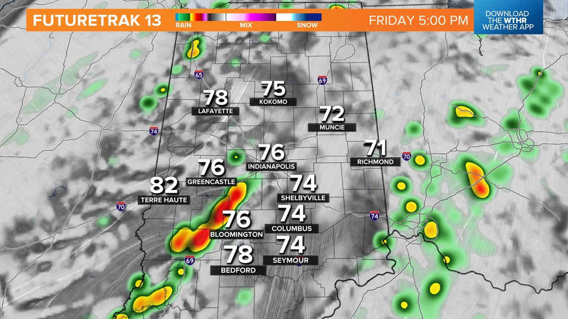
Latest modeling suggests the front will be close enough to trigger scattered downpours and thunderstorms Friday afternoon/evening with potential impacts to some Operation Football playoff games.
There's still plenty of time to iron-out specifics on how the weekend plays-out, but the early call is for less rain coverage on Saturday versus Sunday. In fact, Saturday night into early Monday morning looks rather wet in central Indiana and that includes tailgate plans for the Saints-Colts game. There's a high chance, based on latest guidance, the roof and window will be closed.
Rain may fall heavily at times during that timeframe and there's a growing probability of many areas getting 1"+ rainfall before the Arctic air shuts down moisture and delivers easily the coldest air of the season.

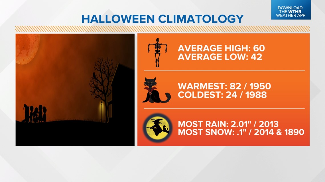


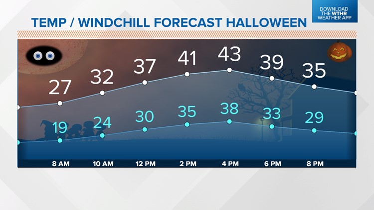
We continue to forecast sharply colder air Monday into at least the middle portion of next week, including what could be Indy's coldest Halloween temperatures since 1954. We're still forecasting lows in the 20s, highs in the low-to-mid 40s, trick-or-treating windchills in the teens-to-lower 20s, and the possibility of flurries/snow showers Tuesday night into early Wednesday. Stay tuned for updates, but plan on a chilly Halloween.