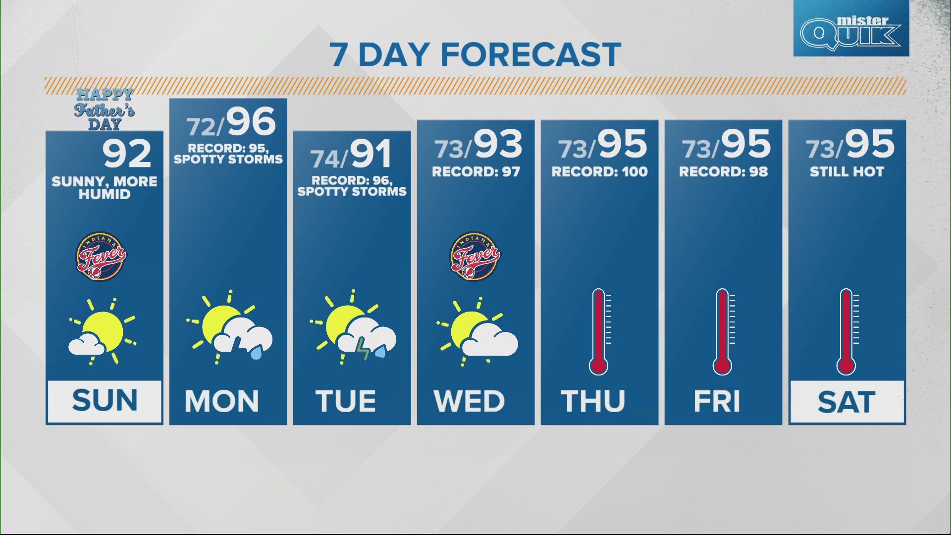
INDIANAPOLIS — The main weather story for the extended forecast will be the heat and humidity. Not only are air temperatures expected to reach the low to mid 90s between now and next weekend, high dew points, humidity, and "feels like" heat indices will increase the risk of heat-related illnesses.
This is especially true for those who are young, elderly, or who spend a prolonged amount of time outdoors.
Important safety information to keep in mind this week:

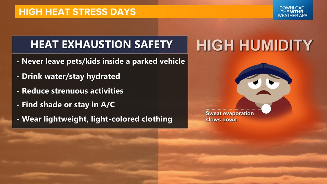
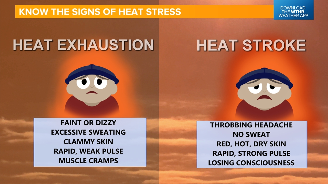
Know the signs and symptoms of a heat-related illness including heat exhaustion and heat stroke!

TODAY:
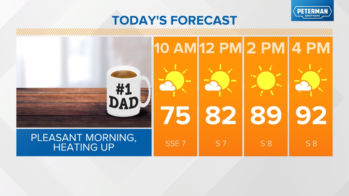
Dew points will climb back into the mid 60s this afternoon bringing a more humid feel to the air. We'll see the first 90-degree day of the year with highs in the low 90s under a mainly sunny sky.

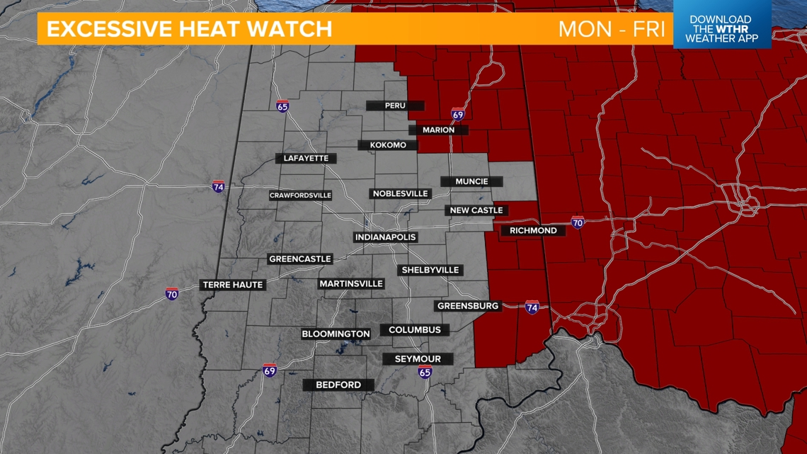
An Excessive Heat Watch will also go into effect starting Monday morning running through Friday evening for the eastern tier of the state.

TOMORROW:
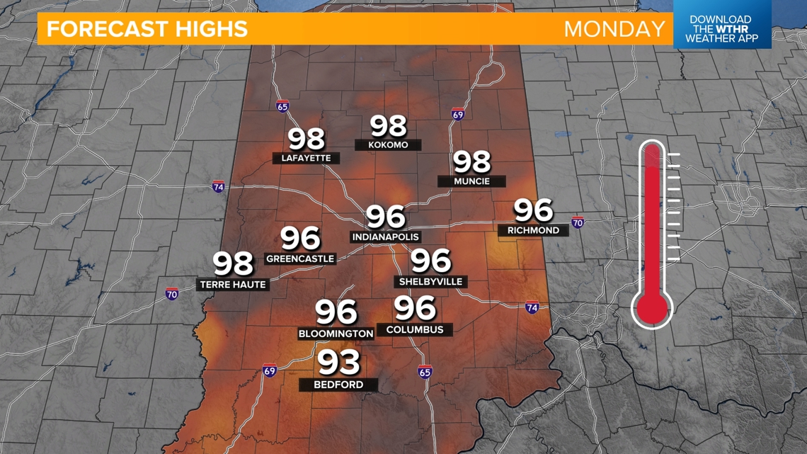
Dew points climb to the miserable zone to start the week. The forecast high temperature tomorrow is 96 which would beat the standing record of 95 from 1913 in Indy.

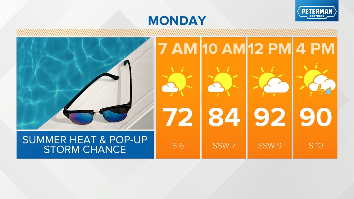

Increased moisture in the atmosphere will prompt the potential of afternoon pop-up thunderstorms during the heat of the day — approximately between 1 p.m. and 8 p.m. Any rainfall is welcomed though as a stretch heat we're anticipating could lead to the "flash drought" if the ground dries out too quickly.

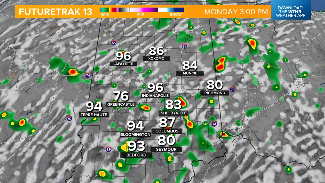
Tuesday will be a similar day with the chance of afternoon pop-up storms with highs in the low 90s. Our stretch of highs in the low to mid 90s continues through next weekend. Long range weather models are hinting at a cold front arriving late Sunday into next Monday which could break the heat streak. Make sure to check back for the latest updates.


