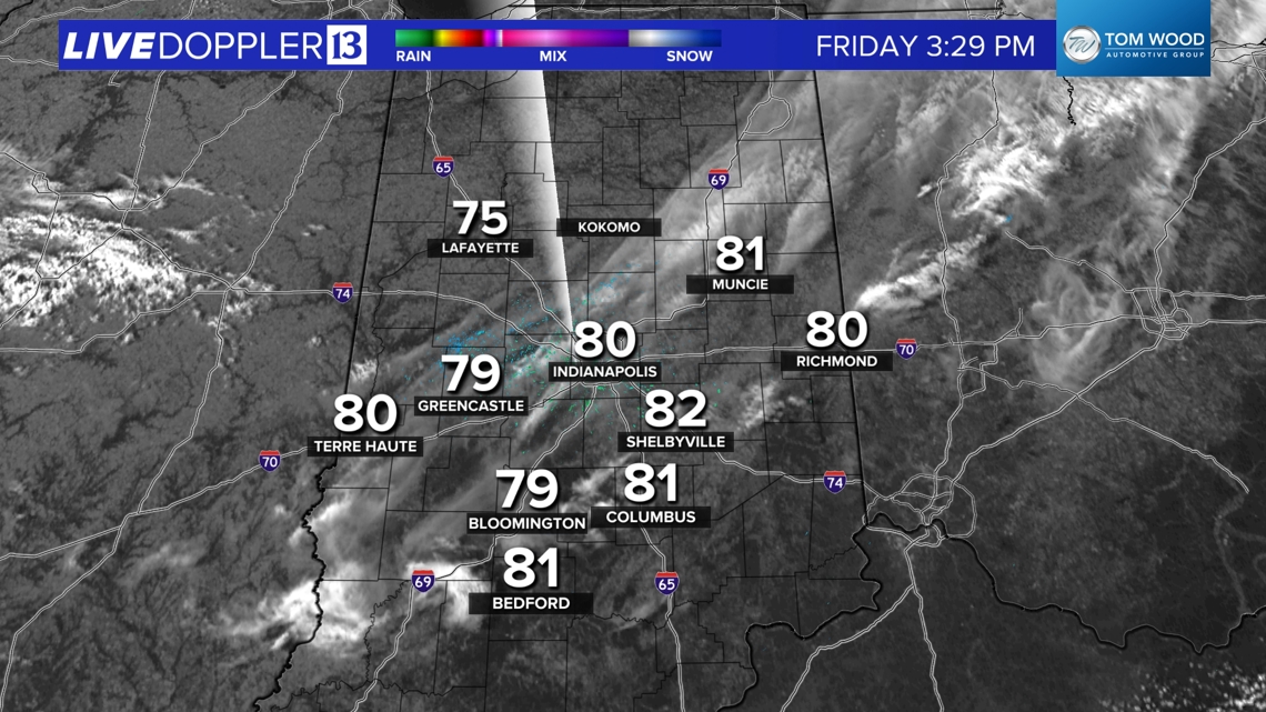
INDIANAPOLIS — Temperatures hit 80°+ in parts of Indiana this afternoon as the morning rain/thunderstorm complex expectedly diminished upon encountering drier air locally. Clouds continue to thin and we're still on target for a rather pleasant Week 7 of Operation Football this evening. Expect 70s at most kickoffs around 7 p.m. and gradually falling into the 60s by the 4th quarter.

Despite being above average, 80°+ temperatures aren't unusual this time of year with average date of Indianapolis' last 80° being Oct. 7. The latest 80° day on record in Indianapolis was Nov. 1, 1950.
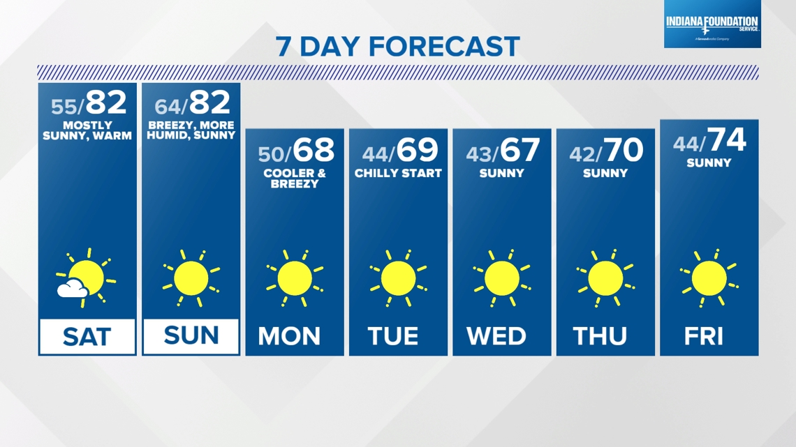
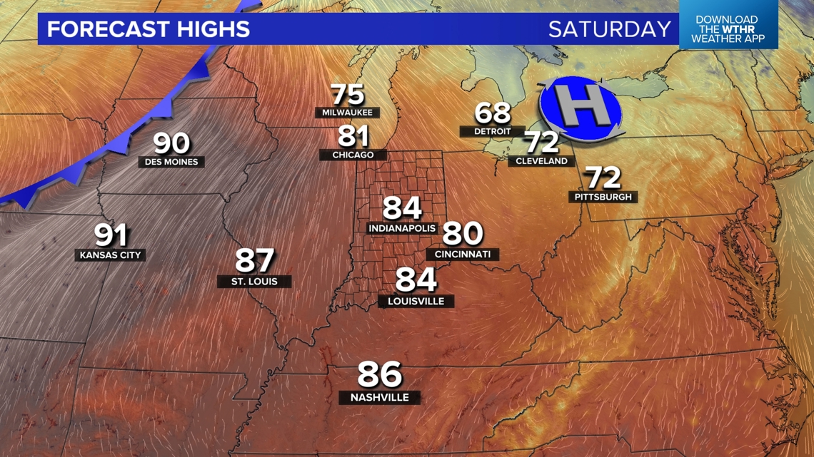
We expect temperatures to be warmer this weekend with highs in the lower 80s in eastern Indiana Saturday, mid-80s and central and potentially upper 80s in western-southwestern parts of the state tomorrow afternoon. The average high is near 70° this time of year. So those numbers will be a good 10° to nearly 20° above average for early October.

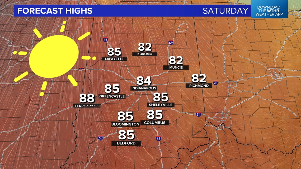


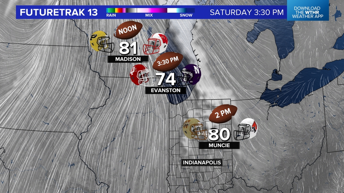
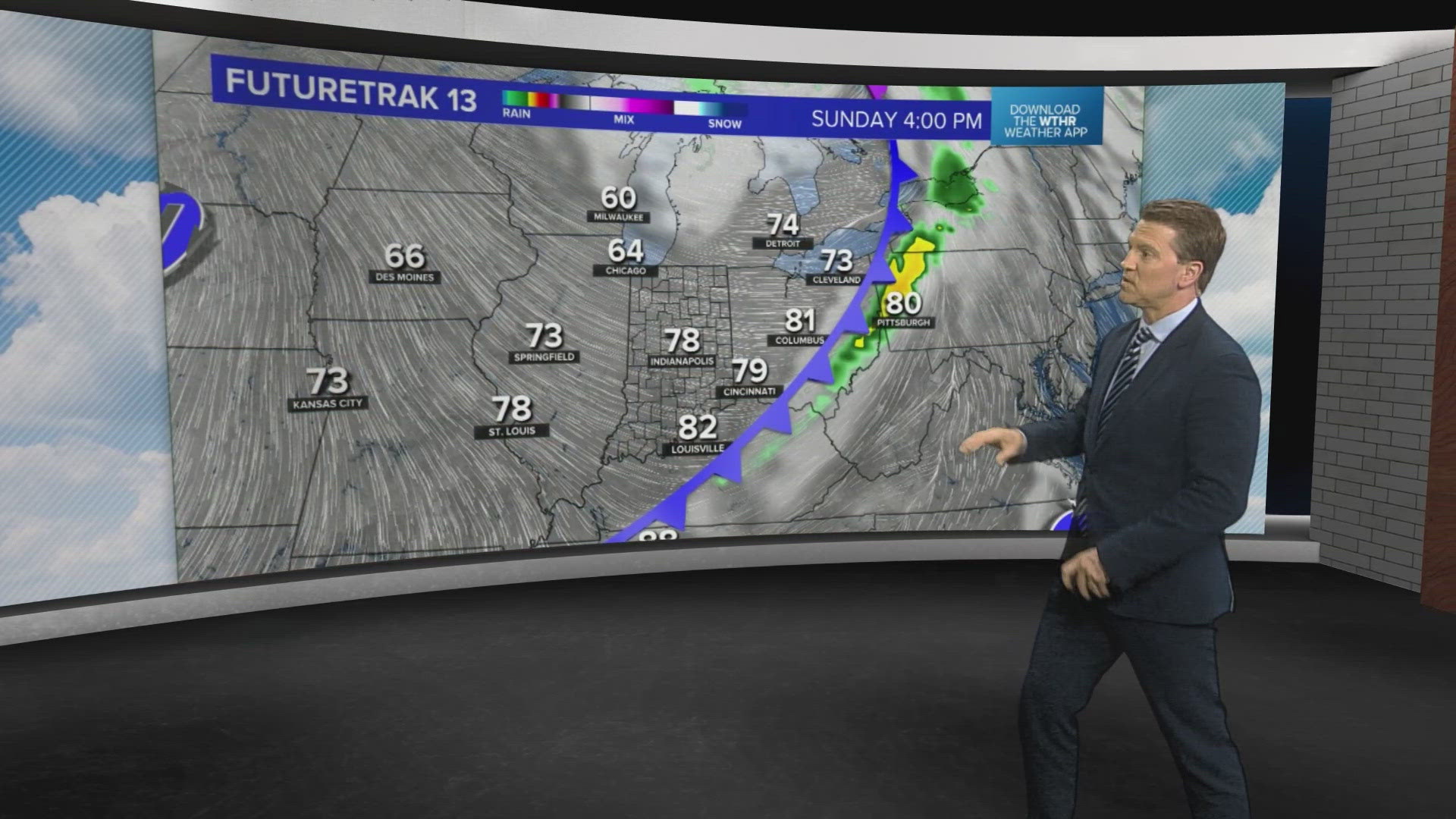
A breezy south-southwesterly teaming up with abundant sun is doing the trick on Saturday. And again, this warmth is not just in Indiana. Much of the eastern U.S. experiences above average temperatures this weekend and that includes Madison, Wisconsin and Evanston, Illinois, where Purdue and IU play respectively tomorrow. Click here for a look at kick-off conditions of Top 25 college football games and NFL games this weekend.

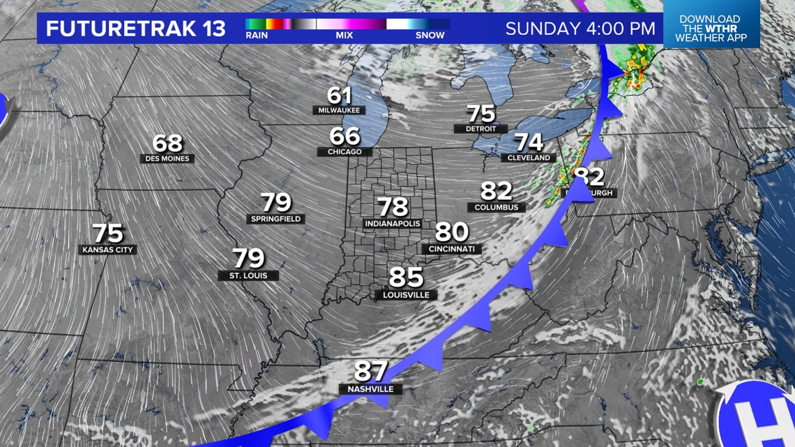

Though a wind-shift from west to east occurs by Sunday afternoon, we'll still be in the 80s to finish the weekend. Though Sunday will be noticeably more humid, the moisture levels and quickness of the frontal passage won't support precipitation locally. Showers may ignite east of the Indiana/Ohio state-line, but we're just not expecting even much cloud cover with this front on Sunday. You'll definitely feel the higher dewpoints and breezy conditions that emerge with gusty west-northwest wind to finish off the weekend.

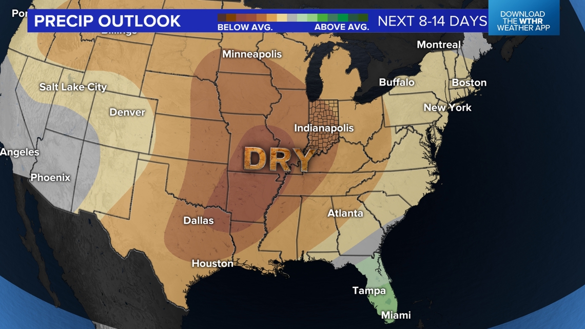
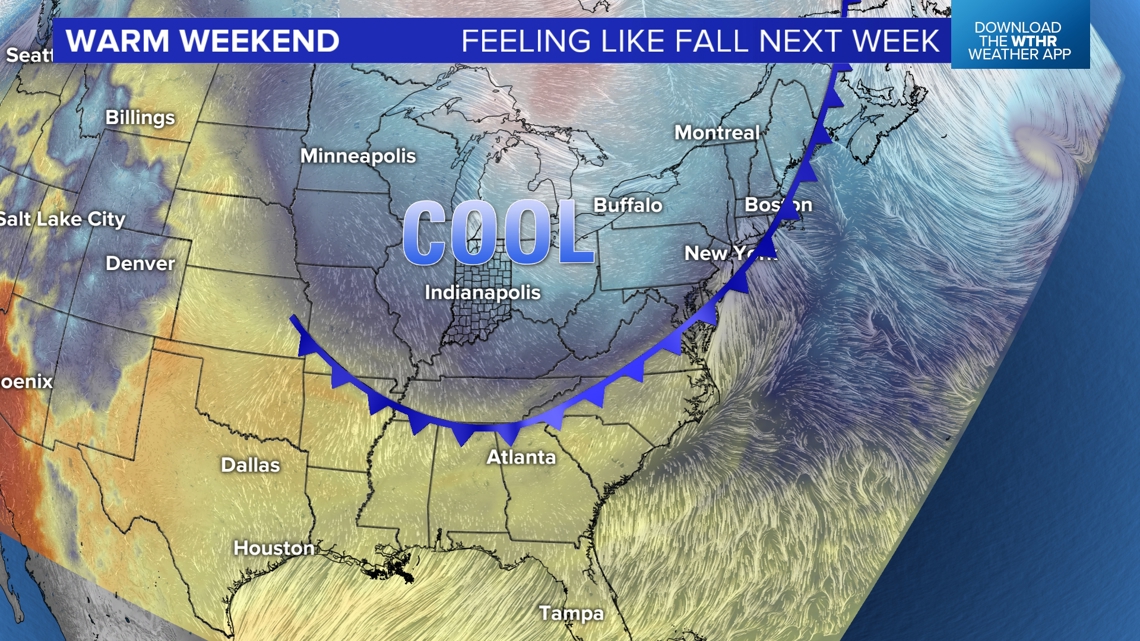
The bigger impact from that front will much cooler air arriving Sunday night and lingering most of next week. While afternoon high temperatures reach the upper 60s to near 70° daily next week, you'll notice chillier mornings in the mid to lower 40s. It's possible some areas dip into the 30s at times next week. But the same set-up that's bringing the cool down also brings abundant sunshine heading into next weekend with this latest substantial dry spell expected to last for a while.