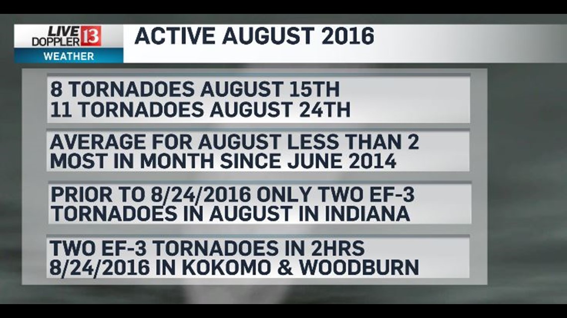
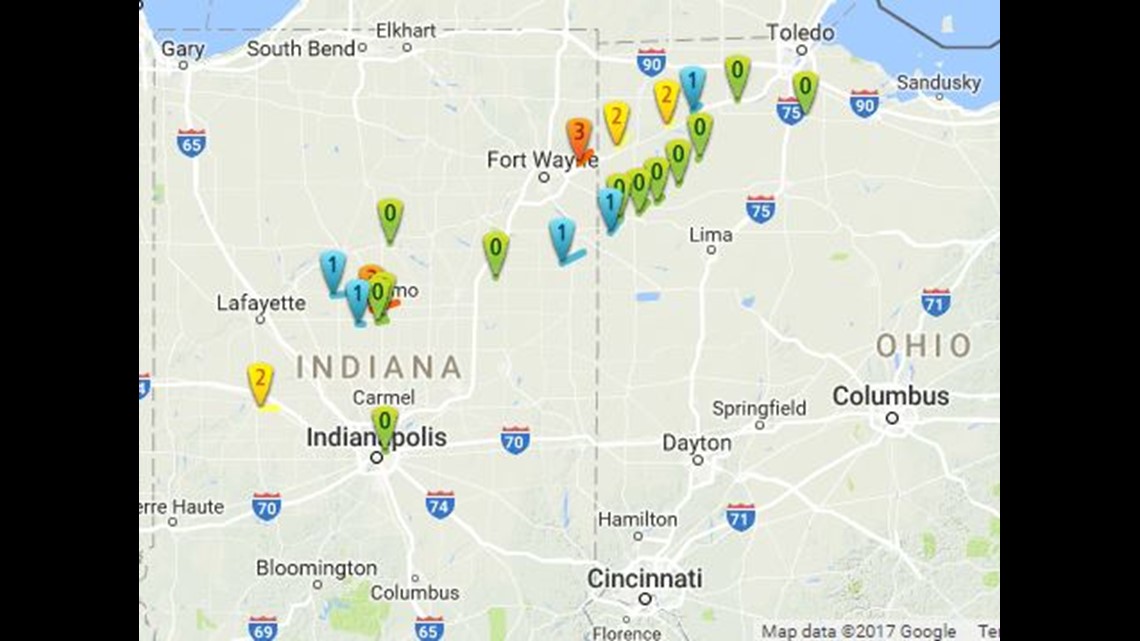
It's been a year since a rare non-tropical August tornado outbreak occurred over north-central Indiana and northwest Ohio...though tornadoes also impacted southwestern Ontario too. I'm still amazed at the numbers. 22 tornadoes in Indiana and Ohio...two of which were violent EF-3s. Thankfully no fatalities and only 20 injuries were reported.

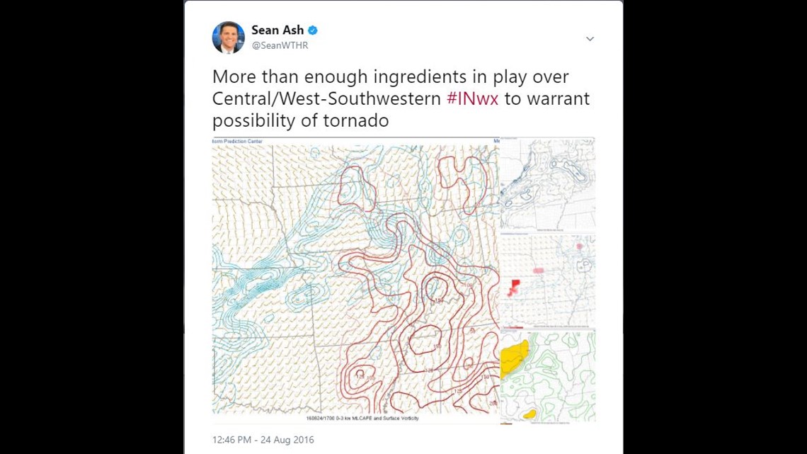
One year ago, after analyzing atmospheric conditions during the WTHR Noon show, I tweeted my concern regarding tornado potential. This was based on low cloud bases from extreme low-level moisture combined increasing wind shear/instability in the lowest levels of the atmosphere. But never in my wildest dreams did I envision long-track supercells and an Indiana state record for August tornadoes in a single day.

At the beginning of the day the odds of a tornado seemed slim to none. In fact the Storm Prediction Center didn't even introduce a 2%+ probability (within 25 miles of a point) until the mid-afternoon update.

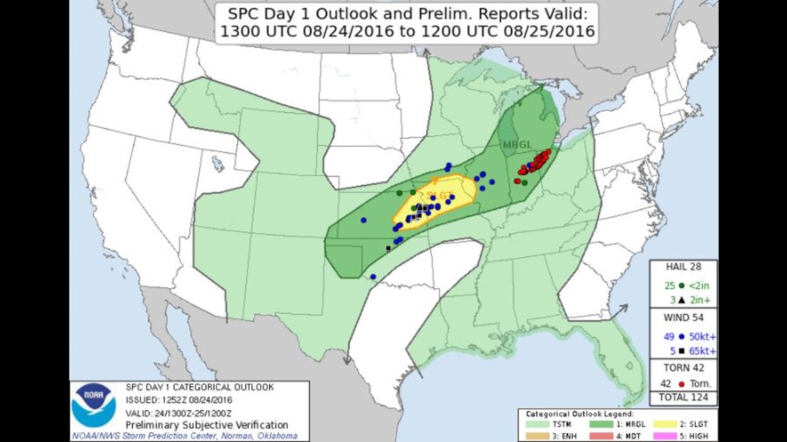

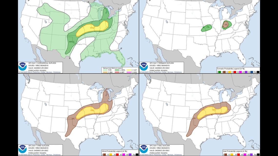
That's certainly not a slam on the great minds at the SPC, but more to underscore the subtle ingredients that came together to produce multiple rotating storms. Dr. Jeff Frame, a clinical assistant professor of Atmospheric Sciences at the University of Illinois, did a truly fantastic job of explaining why the "surprise" outbreak took place: http://www.ustornadoes.com/2016/08/26/surprise-indiana-ohio-tornado-outbreak-august-24-2016-happened/
11 tornadoes dropped in Indiana... the most notable being the EF-3 that damaged parts of Kokomo and another EF-3 in Woodburn in northeastern Indiana. Both had peak wind over 150mph. Thankfully both tornadoes had significant lead time of Tornado Warnings.
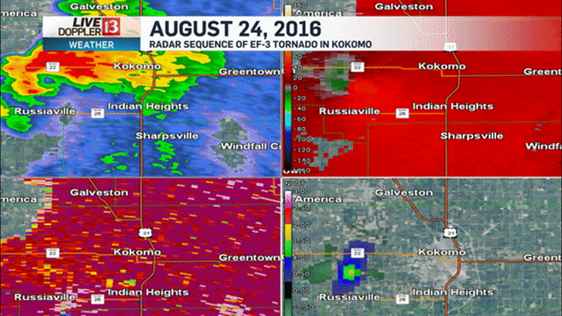
Radar imagery shows the sequence of the tornadic supercell that produced peak wind of 152mph as the tornado cut a near 9 mile path through the south side of Kokomo with a maximum width of 300 yards. The paneled radar imagery shows reflectivity (upper left), wind velocity (upper right), correlation coefficient (lower left), and normalized rotation (lower right). Significant gate-to-gate wind shear is noticeable in the velocity images as is a tornadic debris signature (TDS) in the lower left panel. That blue circled area is the radar detecting debris being lofted from the tornado... and is typically reserved for more violent tornadoes.


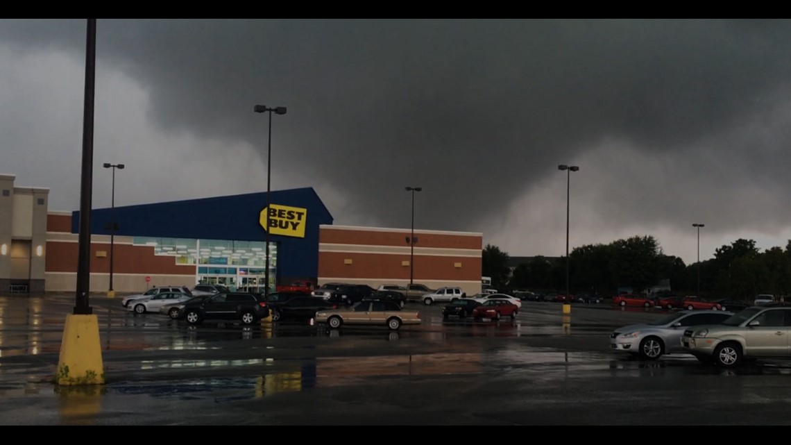
The Live Doppler 13 Weather Team was in action with on-air coverage beginning with the first tornado in Montgomery County and not finishing until after 8pm. Again I can't stress enough how thankful I am that there were no serious injuries especially a Starbucks was leveled in Kokomo.

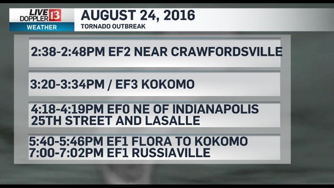
August 2016 was one for the record books in Indiana...producing nearly 20 tornadoes in a month that averages less than two climatologically. Prior to August 24, 2016 there had been only two EF-3 tornadoes in August in Indiana. There were two within in two hours on August 24, 2016.

