INDIANAPOLIS — So far, the forecast of this storm for central Indiana is essentially playing out. At this hour, much of the area is within the expected heavy rain axis that's delivering much-needed liquid to help bust up drought conditions.
- RELATED: Live Doppler 13 Radar
Most of what's falling this afternoon is rain, but there have been some reports of heavy, wet snow mixing in eastern and northern Indiana. In fact, it's snowing heavily enough to produce slushy accumulations of snow on sidewalks, streets and ramps. This is expected to transition back to rain, but it's sign of the strong atmospheric lift approaching that cooling the air enough to produce heavy snow rates and some thunder, too!
The 1"-2" rainfall forecast will easily verify and comes on the heels of the soaker we had Tuesday. Combined, they've put a major dent into the drought and provide the wettest soils we've had in quiet some time.
There's no significant changes to the timing and expectations of this system.... with the exception of the narrow area that had thundersnow and slushy roads for a few hours.
However, latest analysis shows a weaker-than-modeled surface low pressure system over central Illinois. The most likely track of the center(s) will be just northwest of Indianapolis. As we've said this week, that's not a favorable snow track for central Indiana and typically delivers more wet than white.

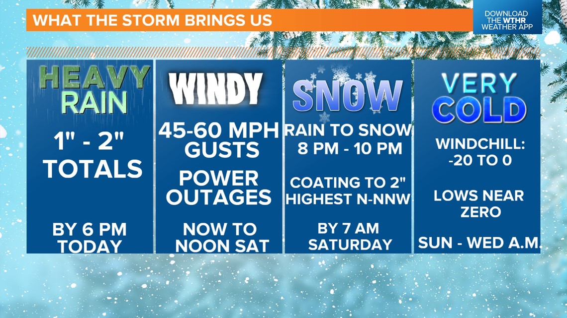
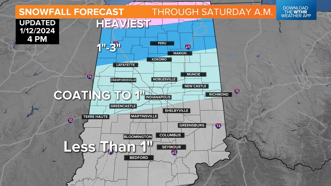
But we still expect a transition to frozen precipitation between 7 p.m. and 10 p.m. from west-northwest to east this evening. We don't anticipate a lot of snow, but whatever falls could go a long way, as sub-freezing temperatures may result in black ice/slick spots overnight into Saturday morning.
A coating to 1" is the forecast for the metro area, with the better chance of eclipsing 1" north-northwest of I-70. But remember, don't focus much on amounts but rather impacts of what does fall. Wind gusts have lagged this afternoon, but we expect an increase in wind after 5 p.m. as the storm center moves northeast and intensifies.


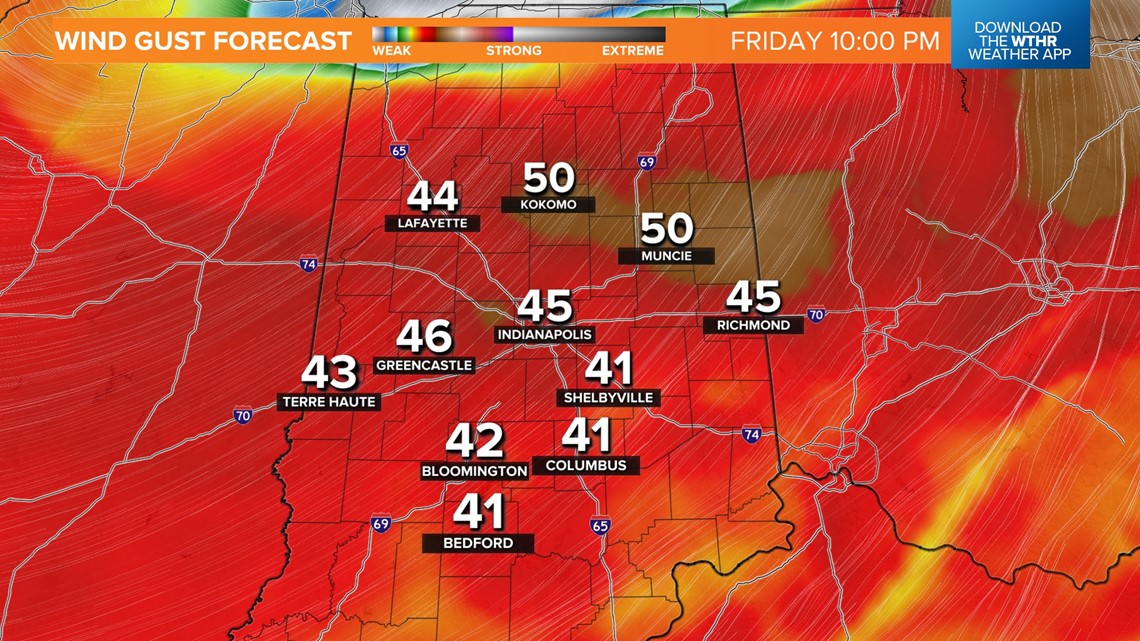
Gusts much of tonight into Saturday morning peak in the 45-60 mph, causing brief whiteout conditions, some wind damage and more power outages. Please have a plan in place in the event your power goes out tonight, with lows nearing 20° Saturday morning, marking a prolonged streak of below-freezing days.

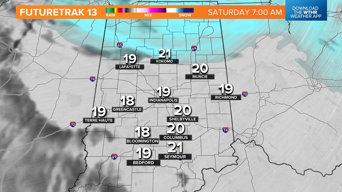

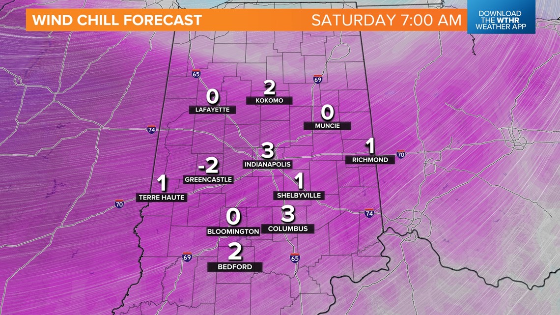
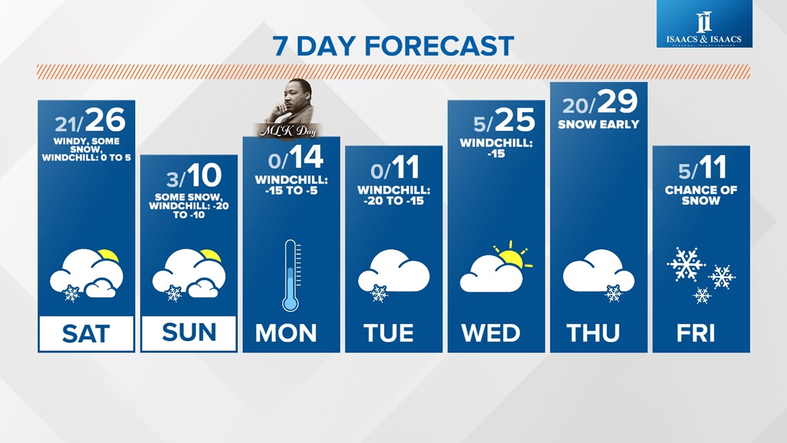
Windchills Saturday morning will be near zero, but the coldest is yet come. A subtle disturbance triggers more light — but possibly impactful — snowfall Saturday evening, and there will be more of these in the days ahead, proving to be efficient and sneaky snowmakers within the bitterly cold air.
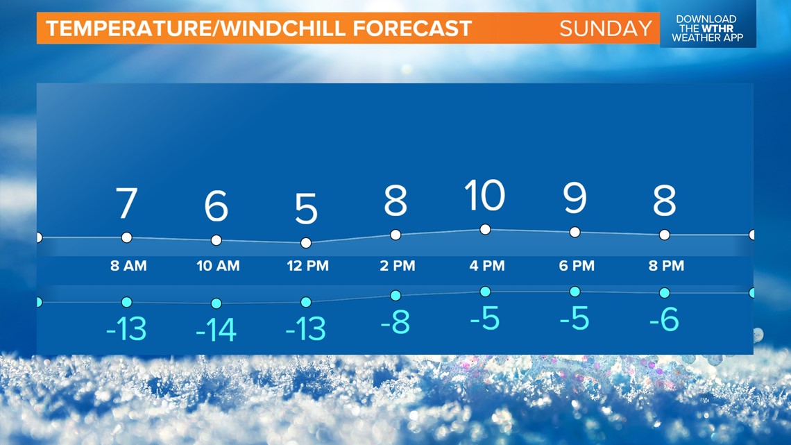
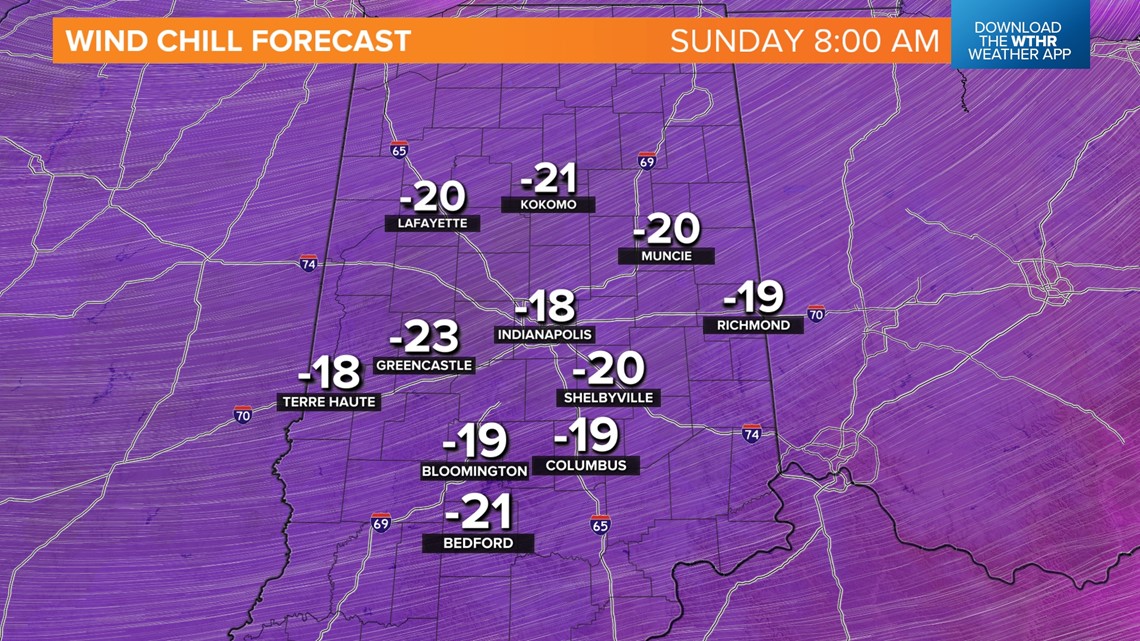
It'll be noticeably colder Sunday with morning windchills in the -20° to -15° range and "highs" struggling to hit double digits. Bitterly cold air lingers into Wednesday morning before "warming" into the 20s. Another arctic front is on deck Thursday afternoon into Friday.

