INDIANAPOLIS — It was noticeably "warmer" to finish the bitter weekend as temperatures recovered into the 20s Sunday afternoon after the brutal sub-zero lows Sunday morning. That will be the coldest air we'll experience for a while. Yes, we're still going to be significantly warmer this week, but it poses some other weather challenges ahead.
However, the first half of Monday will be just cloudy and quiet. With a blanket of clouds overnight, low temperatures will be 15°-20° warmer for most to start the day.

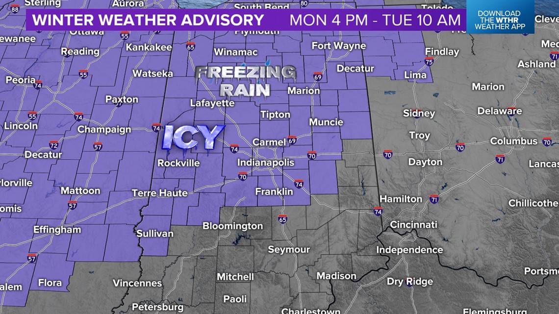

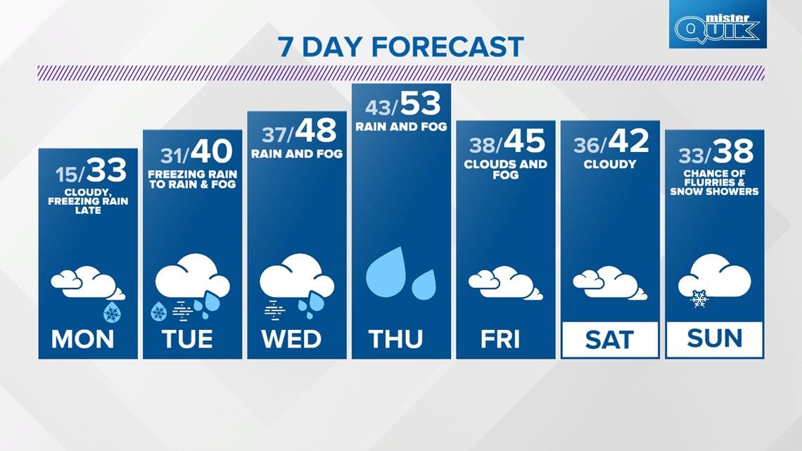
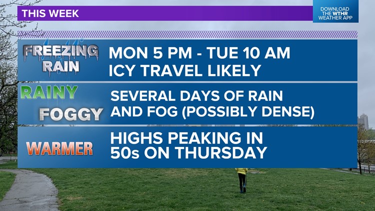
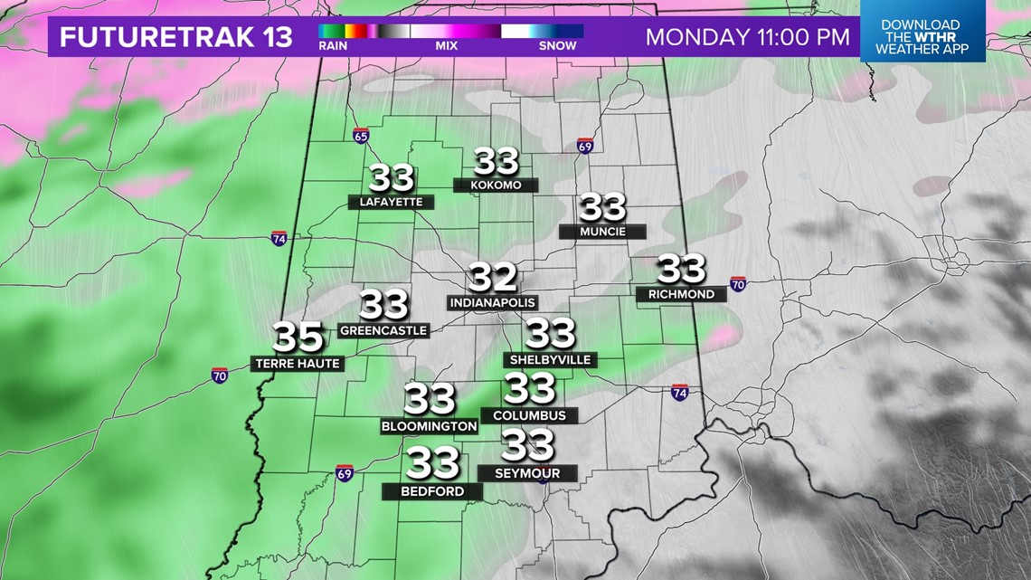
As we've mentioned for several days, a period of freezing rain Monday afternoon into Tuesday morning will be impactful to roads and sidewalks. As a result, a Winter Weather Advisory is in effect for a good portion of the WTHR viewing area for what's expected to be varying amounts of ice accumulation on surfaces. Please note that this particular freezing rain setup is different than most, in that concerns of ice accumulation is more so for roads/sidewalks (due to highly frozen ground) versus trees/powerlines (that won't be as cold due to warmer air just above ground level).
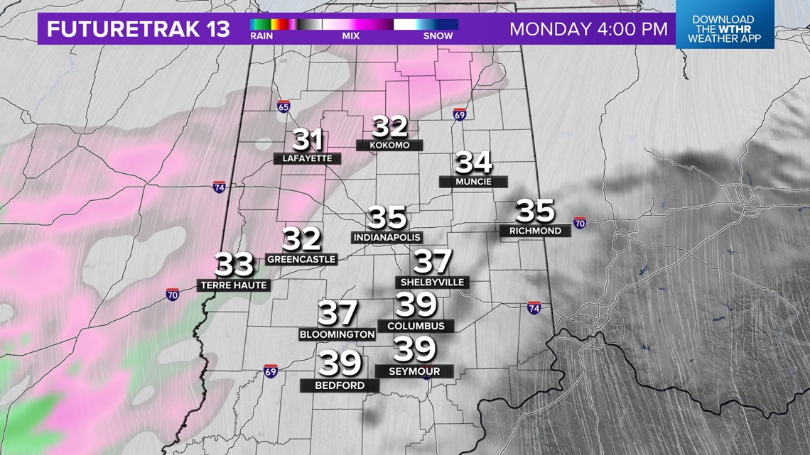
It arrives first in west-central Indiana around 4-5 p.m. Monday and spreads east into the Indy metro area between 6-7 p.m. Monday.


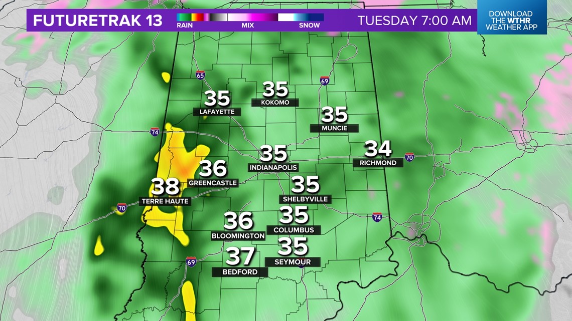
Any ice is bad. Even a glazing can cause travel to be highly impacted. The area most probable to get >.10" is farther west and north of Indy, where it arrives first and lasts longer.
But regardless of where you live, be cautious of potentially slick travel Monday night/Tuesday morning as rain falls on much colder ground that's been frozen for over a week.

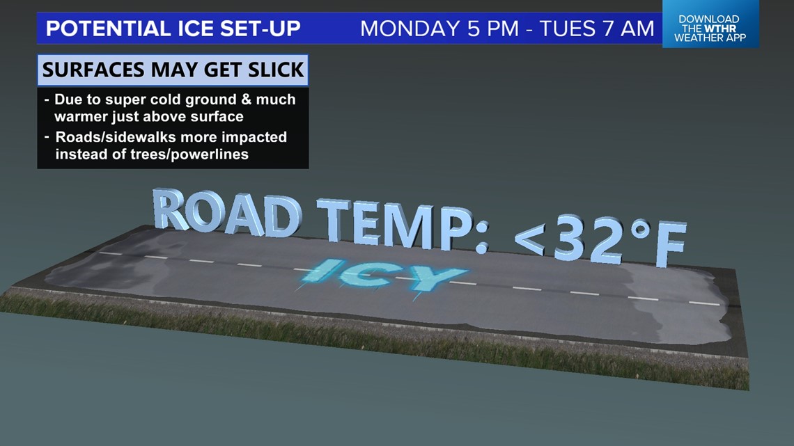

It's conceivable that road conditions lag and stay slick well after air temps reach the mid-to-upper 30s due to the depth of frozen ground.
Impacts to the Tuesday morning and/or some school delay/cancellations are very possible.

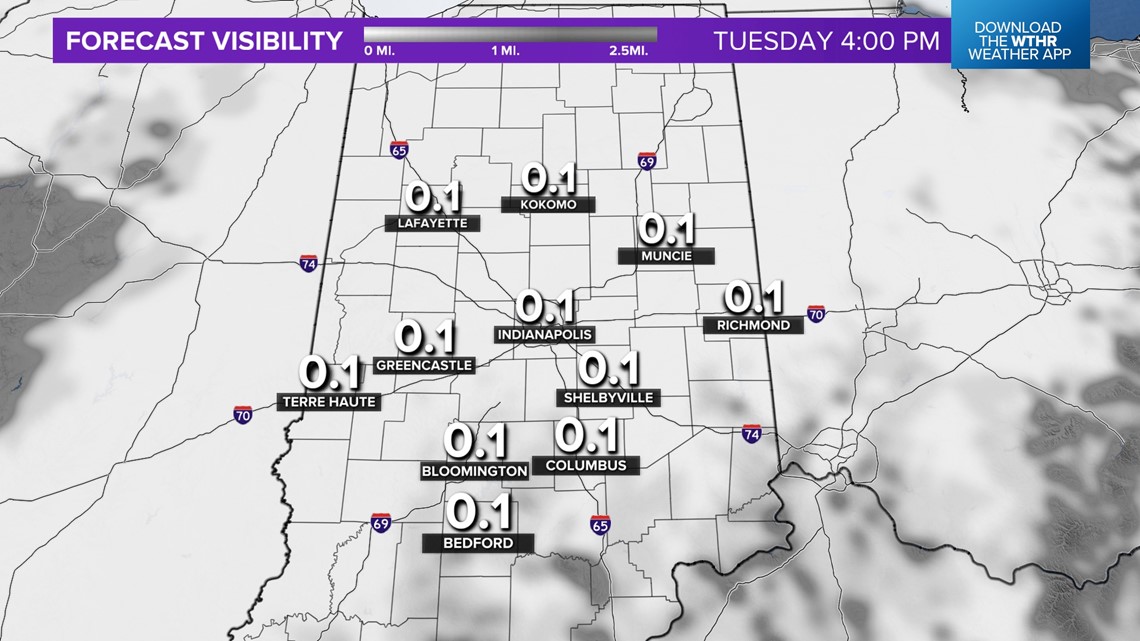

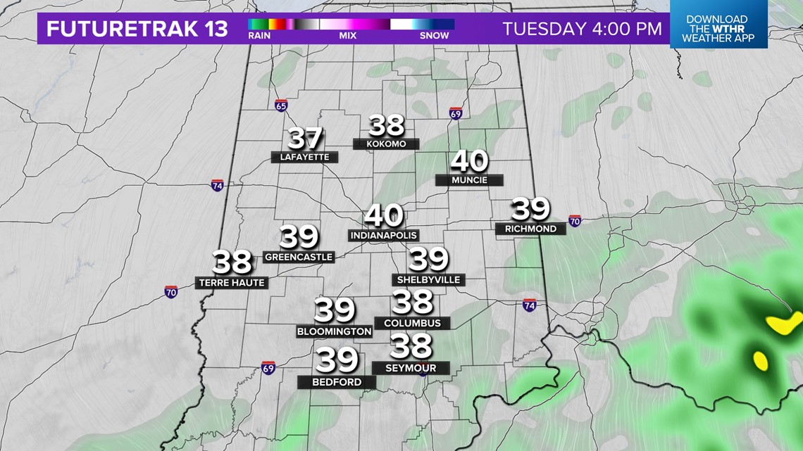
We eventually transition from ice to fog concerns Tuesday afternoon with near-zero visibility possible. Due to the warmer air flowing over the ground, we expect fog/low clouds to linger all week with varying degree of density.
Updates to come as needed. Please be Weather Aware, and follow the forecast closely.