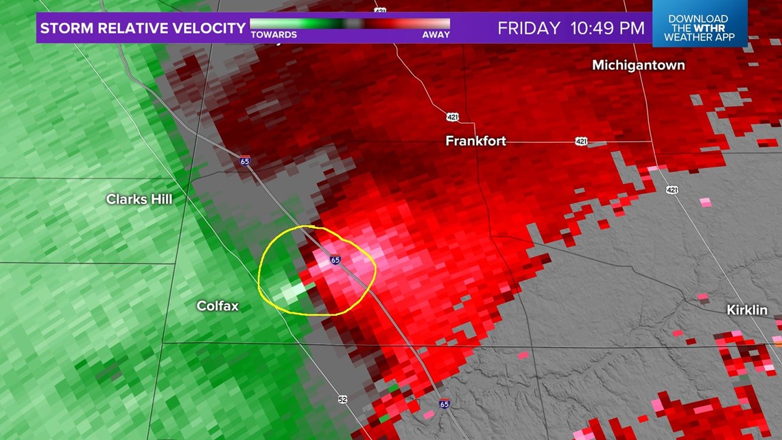
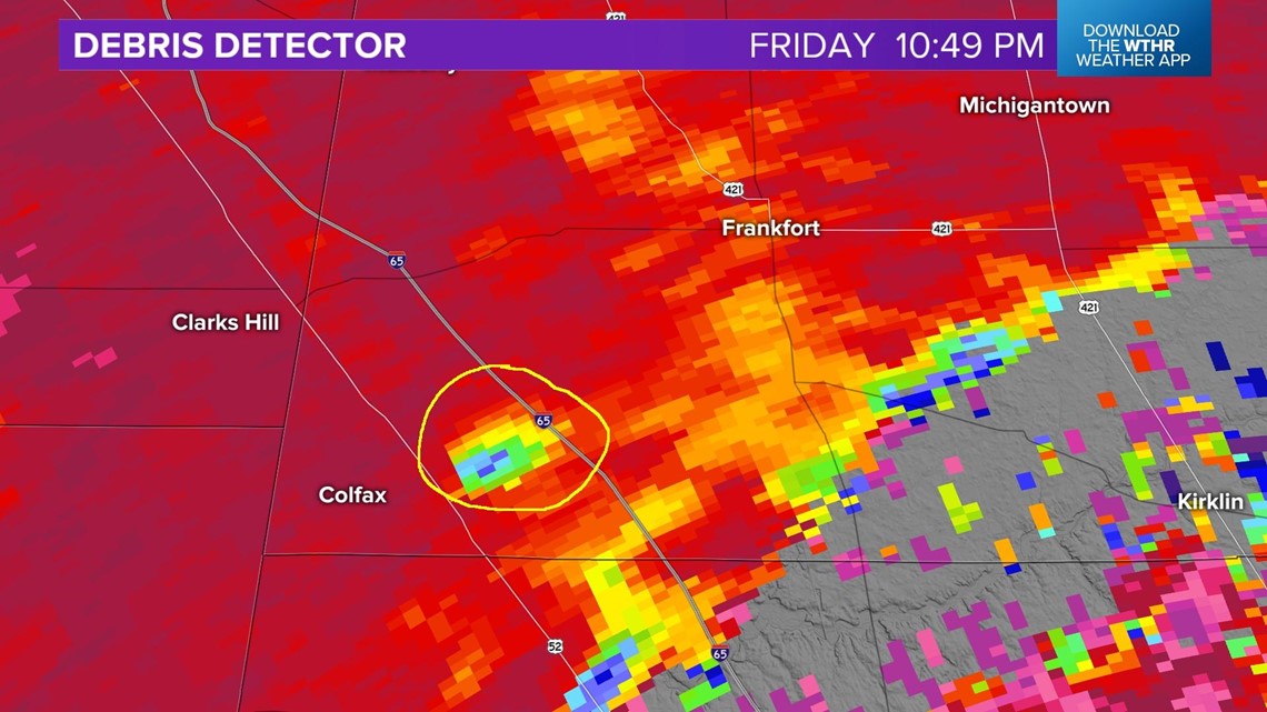
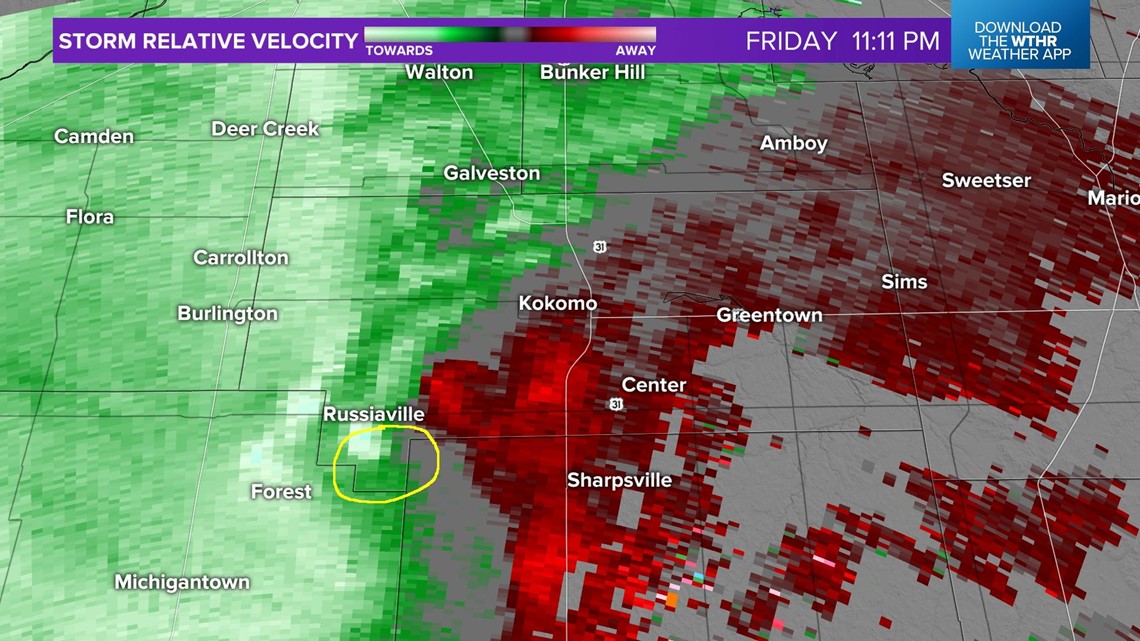
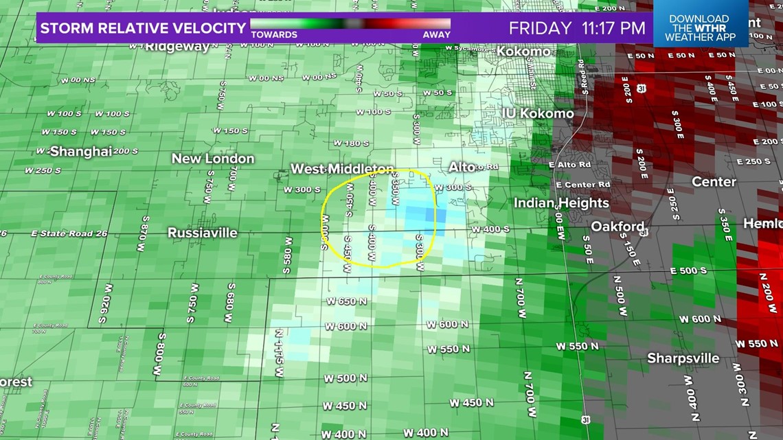
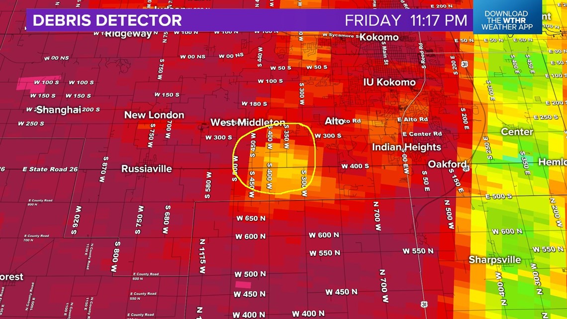
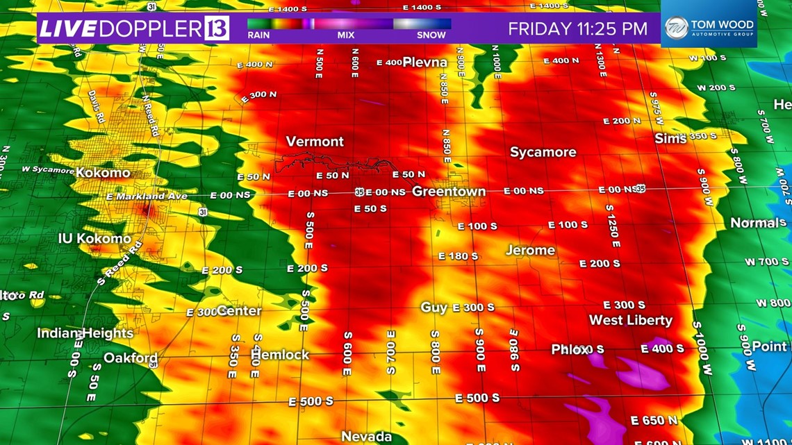
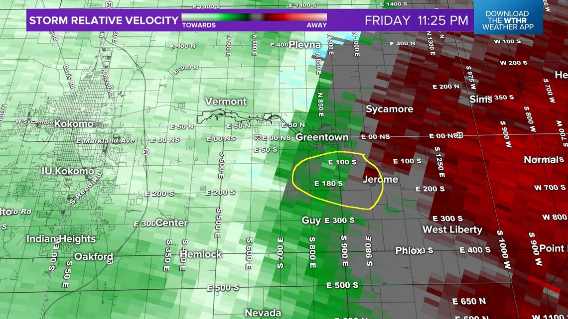
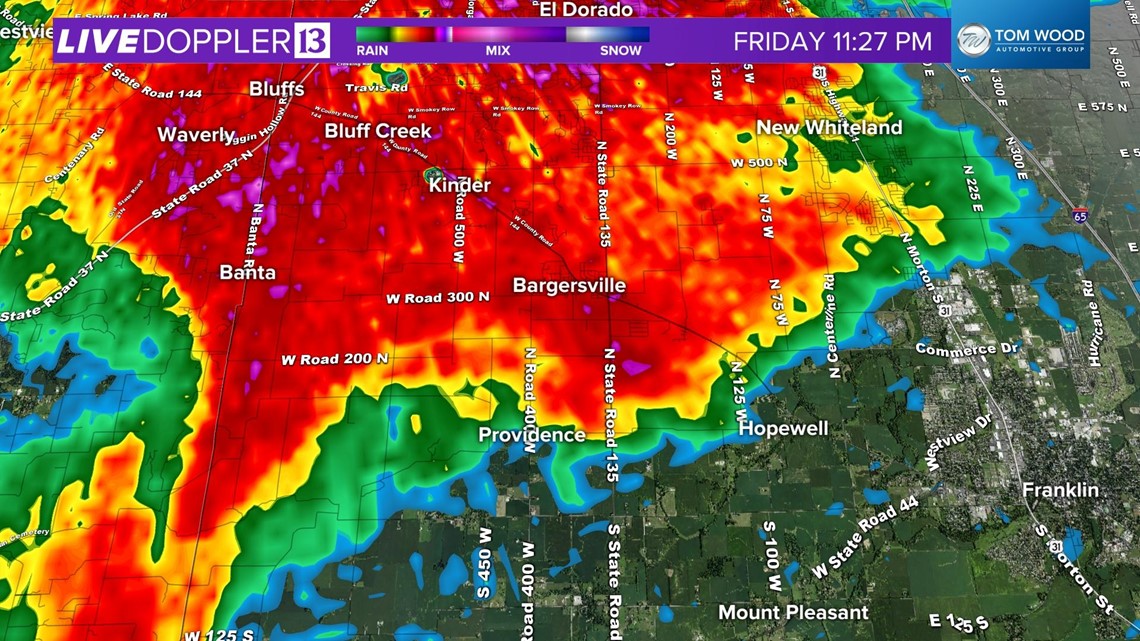
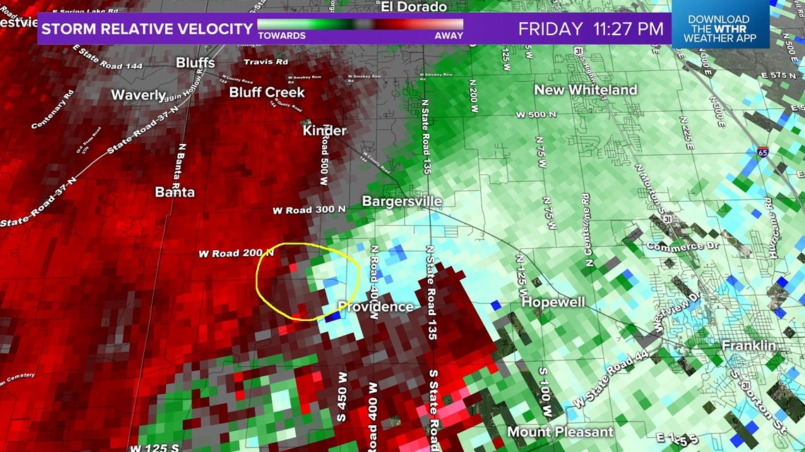
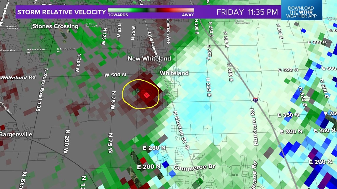
INDIANAPOLIS — The National Weather Service confirmed that seven tornadoes tracked across central Indiana yesterday, March 31, 2023. Below are images from each of the tornadoes, including circled areas on the velocity of where there was wind shear indicated and on the debris detector, where touchdown was likely.
The first tornado hit Sullivan County at 10:23 p.m. There were three fatalities and over 200 homes destroyed.
1. Sullivan County: Merom to Sullivan
Rating: EF3
Peak wind: 155 mph
Distance: 10 miles
Width: 3/8 of a mile
Time: 10:23 p.m. - 10:34 p.m.
Radar reflectivity from Sullivan:

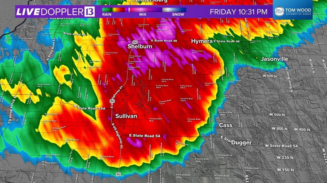
Radar Storm Relative Reflectivity:

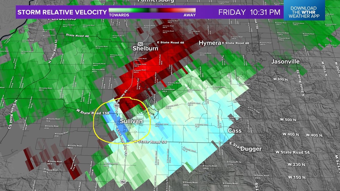
Radar Debris Detector:

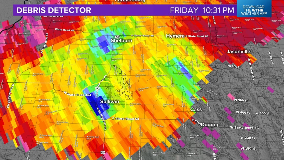
The second tornado developed in Clinton County:
2. Clinton County: Tornado began in Colfax and ended southwest of Frankfort
Rating: EF1
Peak wind: 110 mph
Distance: 6.79 miles
Width: 100 yards
Time: 10:45 p.m. - 10:53 p.m.
Radar reflectivity:

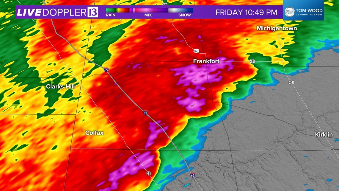
Storm Relative Velocity:

Radar Debris Detector:

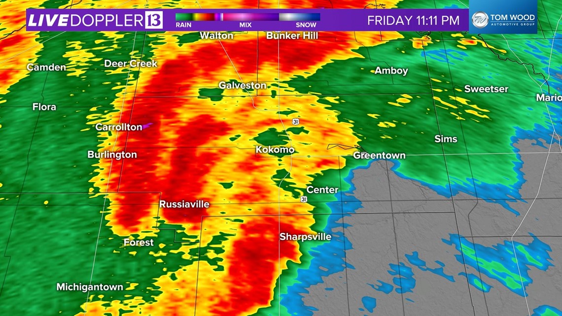
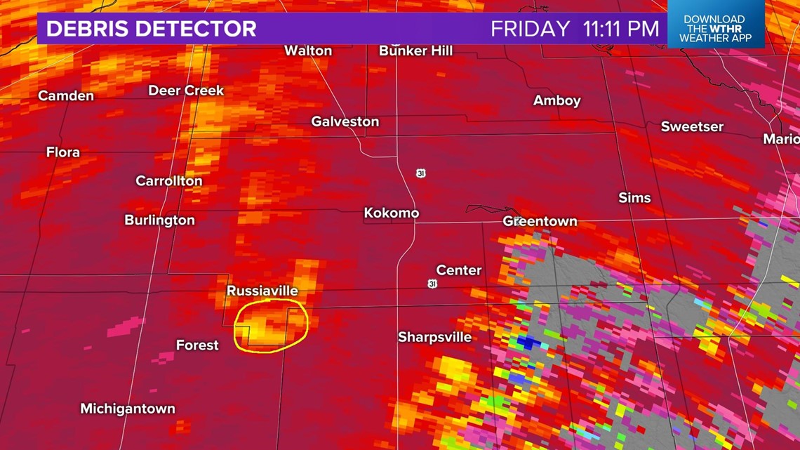
The third tornado touched down in Howard County near Russiaville:
3. Howard County: Tornado began 1 S Russiaville to 1 SSE Russiaville
Rating: EF0
Peak wind: 80 mph
Distance: 0.86 miles
Width: 100 yards
Time: 11:11 p.m. – 11:12 p.m.
Radar Reflectivity:

Storm Relative Velocity:

Radar Debris Detector:

Another tornado touched down in Howard County near Indian Heights. That is the fourth tornado to touch down last night.
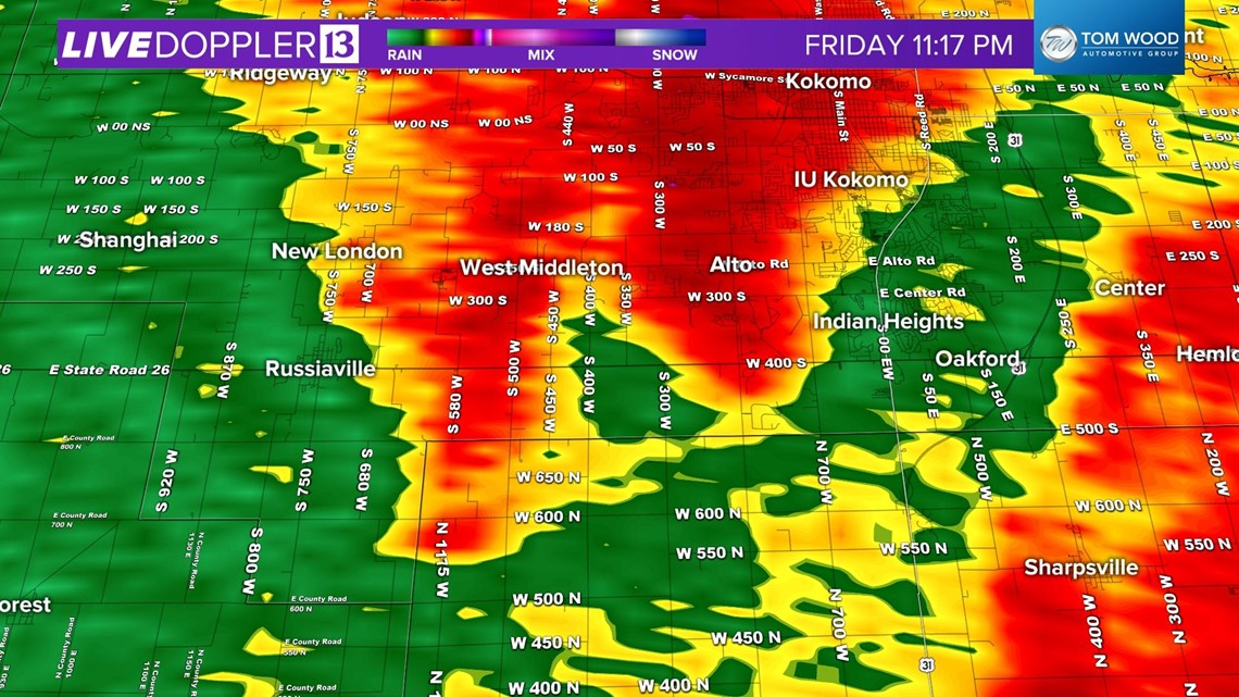
4. Howard County: Brief tornado east of Russiaville to Indian Heights
Rating: EF0
Peak wind: 80 mph
Distance: 0.14 miles
Width: 10 yards
Time: 11:15 p.m. - 11:17 p.m.
Radar Reflectivity:

Storm Relative Velocity:

Radar Debris Detector:

The fifth tornado touched down in Sharpsville and ended in Greentown.
5. Howard County: Tornado began in Sharpsville and ended southeast of Greentown
Rating: EF1
Peak wind: 110 mph
Distance: 6.41 miles
Width: 25 yards
Time: 11:20 p.m. - 11:27 p.m.
Radar Storm Relative Reflectivity:

Storm Relative Velocity:

Radar Debris Detector:


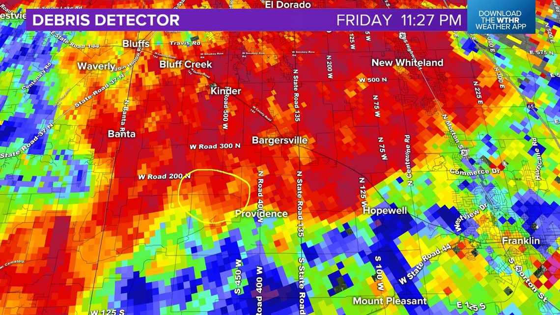
The sixth tornado touched down in Johnson County, near Bargersville.
6. Johnson County: Bargersville
Rating: EF0
Peak wind: 85 mph
Distance: 1.93 miles
Width: 25 yards
Time: 11:27 p.m. - 11:31 p.m.
Radar Reflectivity:

Storm Relative Velocity:

Radar Debris Detector:

The seventh tornado touched down in Whiteland, also in Johnson County.
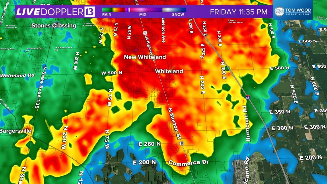
7. Johnson County: Whiteland
Rating: EF2
Peak wind: 135 mph
Distance: 3.54 miles
Width: 316 yards
Time: 11:33 p.m. - 11:39 p.m.
Radar Reflectivity:

Storm Relative Velocity:

The National Weather Services in Indianapolis plans on doing more surveys Sunday morning... focusing on Owen and Morgan counties, along US 231. This would include Spencer, Paragon and Gosport.
The North Webster office of the NWS in northern Indiana, will also do surveys, however, they have not decided where they will cover until the morning.

