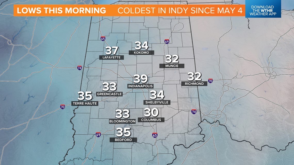
INDIANAPOLIS — Congratulations: You endured the coldest morning of the young fall season. Though the official in Indianapolis was 39 degrees — the coldest since May 4 — many areas away from Indy's urban heat island bottomed-out closer to freezing with areas of frost reported as well.
This will be the coldest temperatures until early next week. Between now and then, unseasonably mild air tops the weather headlines. With abundant sunshine, temperatures recovery some 30+ degrees this afternoon with Monday highs in the 65 to near 70-degree range.


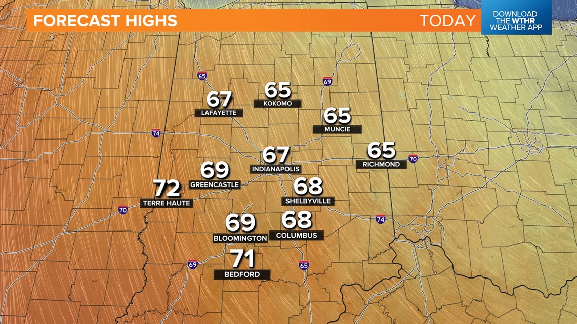
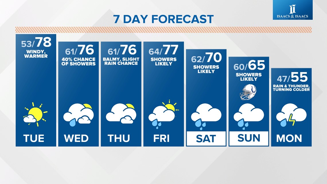
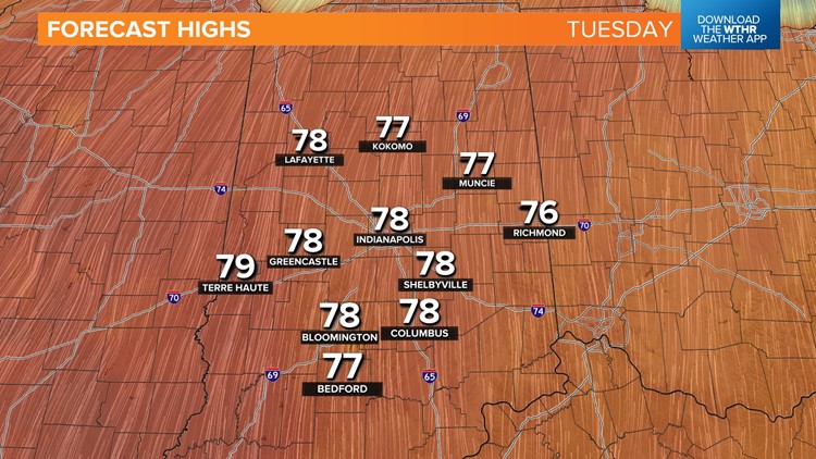
We'll tack on another 10+ degrees Tuesday with temperatures peaking in the 75 to near 80-degree zone. For the remainder of the week, and perhaps the weekend too, temperatures will be a good 15 degrees above average, including balmy overnight lows in the 50s to lower 60s.
Showers are possible later Tuesday, with more numerous areas of rain Wednesday, Friday and this weekend. But there will be plenty of dry time before a widespread rain event emerges on the transition from above average to below sometime between this weekend and Halloween.


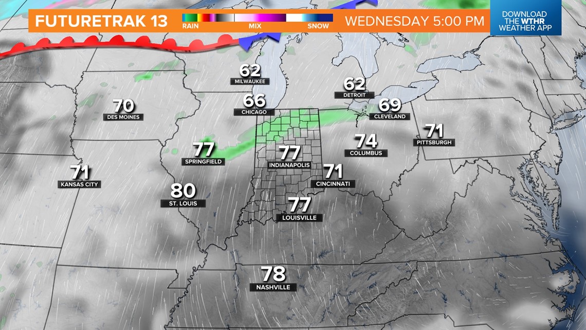
The specific timing dictates whether highs remain in the 70s for the weekend and become colder with higher odds. For now, we're splitting the difference and taking a blended model approach.
Confidence is higher, based on latest guidance, that chillier air will be in place for Halloween and the potential of highs not reaching the 50s. We'll fine-tune the timing of the frontal passage in the days ahead.

