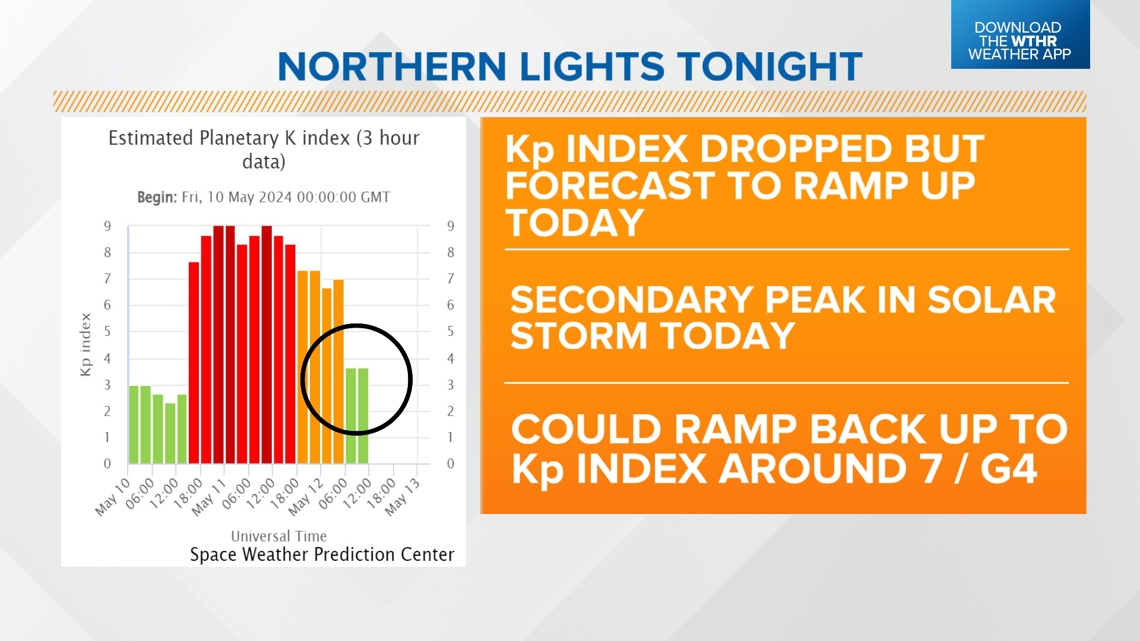
INDIANAPOLIS — Solar activity has diminished quite a bit over the past 12 hours but is forecast to ramp back up later today. The Space Weather Prediction Center is forecasting a secondary peak in solar activity today as the next major Coronal Mass Ejections begin to slam into Earth's magnetic field.

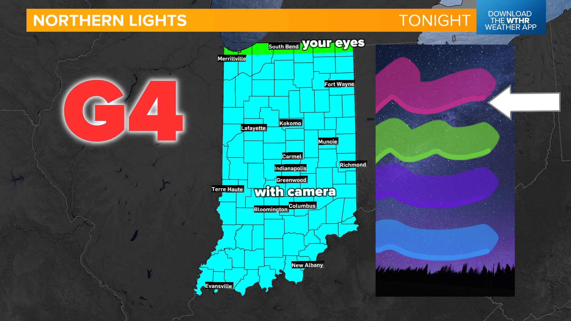
Similar to last night, when a storm ranked as a "G4" is forecast, the viewing line for the aurora will push into lower latitudes. For most of Indiana, this still means it will be tough to see with the naked eye but better through a camera on night-mode. The most likely colors you will see are between the green and pink zone in aurora's highest levels in the atmosphere.

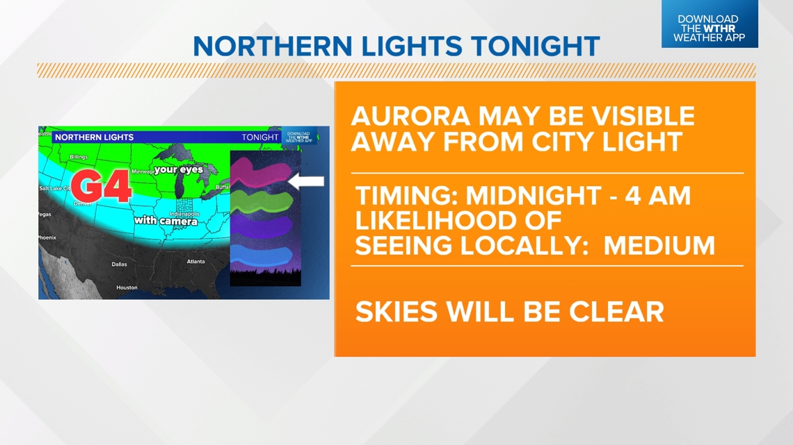
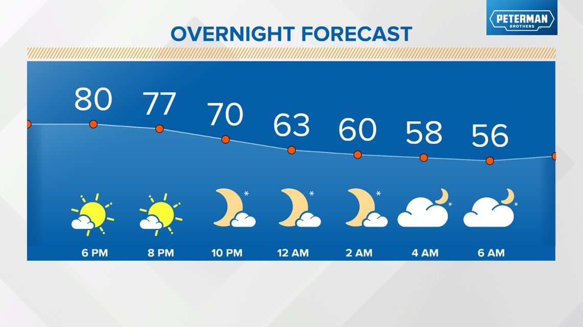
Your best bet is to get as far away from light pollution as possible and time it into the early overnight hours. Skies start clear then become partly cloudy overnight with lows in the upper 50s.

The geomagnetic storm is expected to weaken starting tomorrow.
What are we looking at weather-wise this week?
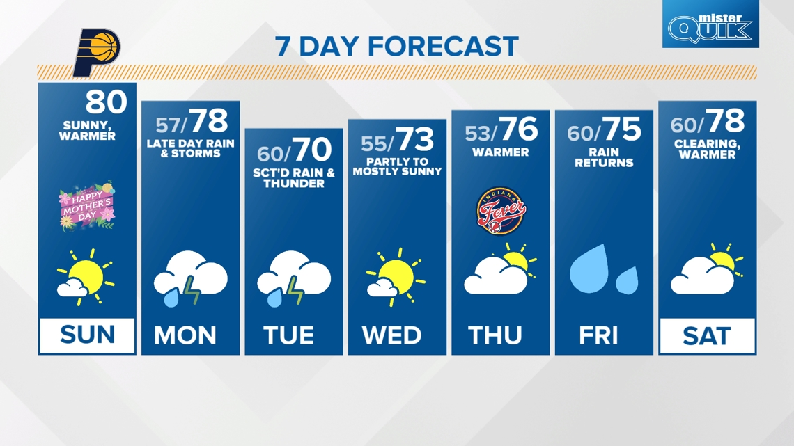
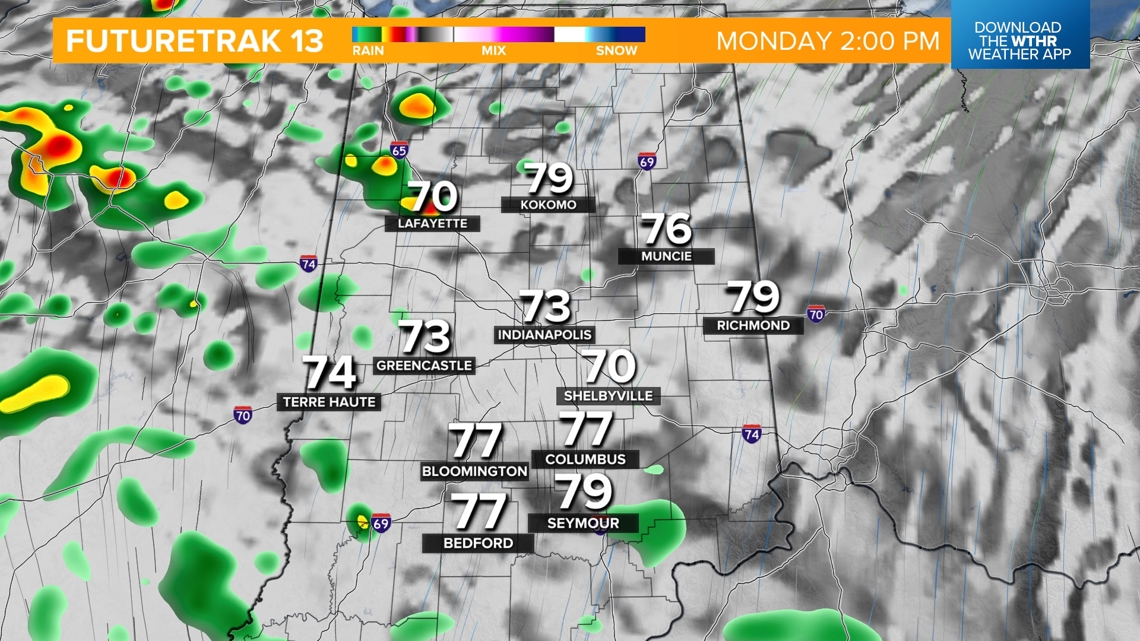
We'll have a dry start to the day Monday ahead of our next weather system arriving later in the day. Rain is likely to return after 2 p.m., first across northern Indiana then becoming more widespread across central Indiana just after sunset. Temperatures will still recover to the upper 70s as we sit on the warm side of this storm system.


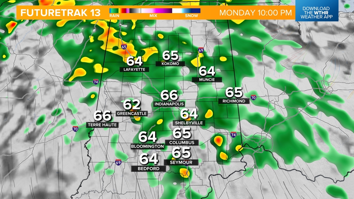
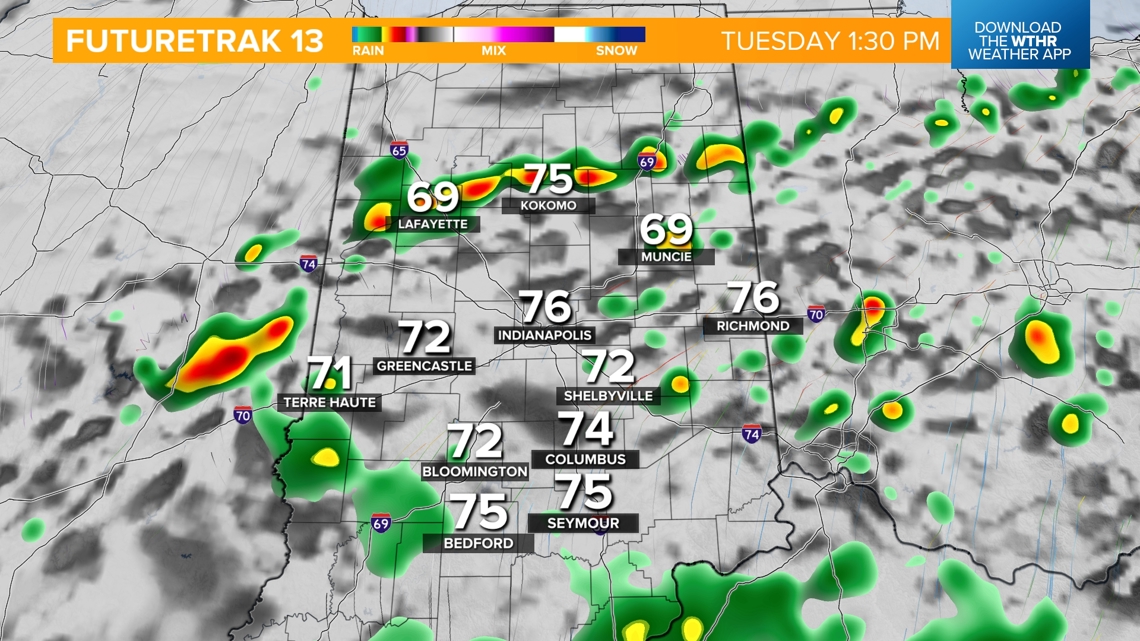
Scattered showers and storms will then be likely overnight into Tuesday as the frontal boundary swings through. We'll be slightly cooler with rain-cooler air Tuesday with highs near 70.

We'll dry out starting Wednesday with sunshine returning and highs in the low 70s. Thursday is looking like the pick of the week with mostly sunny skies and highs in the mid 70s.
Another round of rain will be possible starting late Friday. This should move out by the start of next weekend.