INDIANA, USA — The National Weather Service has confirmed at least six tornadoes for central Indiana from Tuesday's (May 7) supercells. A tornado was also confirmed in southern Indiana and northern Indiana.
(Note: Check back for more updates from the NWS on confirmed tornadoes. The process to analyze and document tornado damage can take a few days.)
Tap HERE to see photos and videos of the tornadoes.
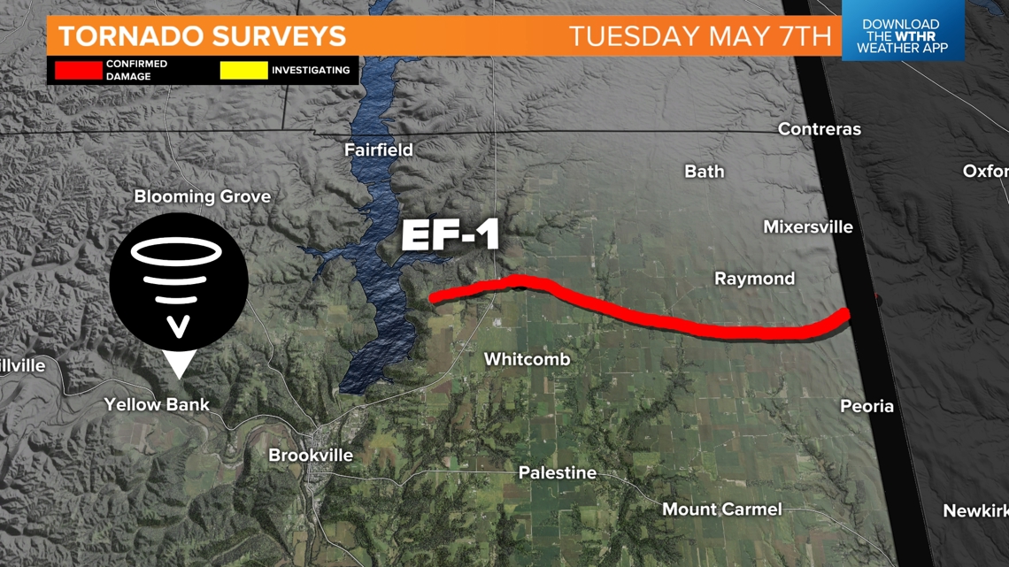
National Weather Service meteorologists are still working on northern Indiana tornado surveys, and crews will be checking out Fayette, Union, Wayne, and Franklin counties soon to confirm if there were gusty winds or tornado touchdowns. They believe EF1 damage is in the area by the lake, over by Hickory Woods Campground in Franklin County. We have counted this tornado in the total tally, but the map is not completely available yet.
We have the results from the surveys across central Indiana.

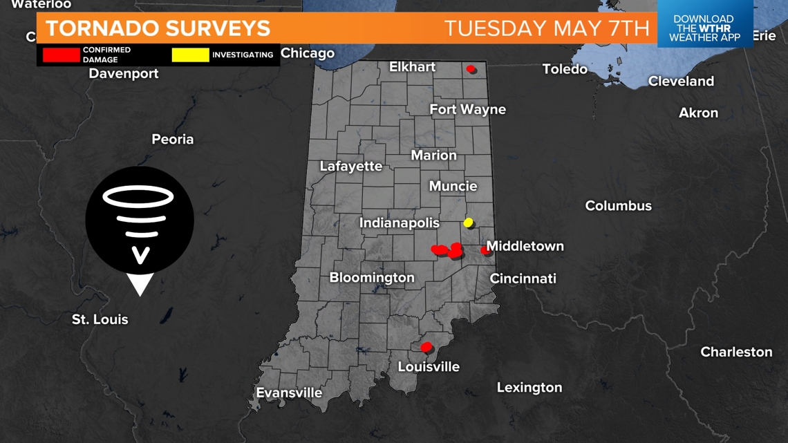
The tornadoes impacted Shelby, Rush and northern Decatur counties. In addition, at least one tornado was confirmed in southern Indiana. Northern Indiana also had tornadoes, but surveys have not been completed yet.
Tornadoes in central Indiana

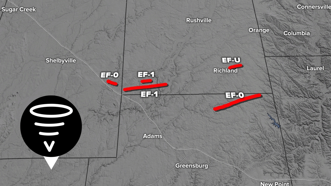
SHELBY COUNTY
- EF0 (peak winds 85 mph)
- Start time — 7:31 p.m., End time — 7:33 p.m.
- No injuries, no fatalities
- Path length: 0.78 miles
- Path width: 50 yards
- Details: Many small and medium sized trees were uprooted or found with large branches broken off. Nearby homes had minor room damage with some singles missing and gutters torn off. An old barn was found with some moderate roof damage.
RUSH COUNTY
- EF1 (peak winds 110 mph)
- Start time — 7:45p.m., End time — 7:46 p.m.
- No injuries, no fatalities
- Path length: 0.16 miles
- Path width: 30 yards
- Details: This brief tornado hit a metal barn and threw the debris in a circular pattern, dissipating in the field to the east next door. Grain silos and a home on the other side of the field were untouched.
- EF-Unknown
- Start time — 7:47p.m., End time — 7:53 p.m.
- No injuries, no fatalities
- Path length: 0.77 miles
- Path width: 30 yards
- Details: Video proof of this storm, only touched fields. Small stalks from old soybeans were ripped up and swirled. This tornado didn't cause any damage so it is classified as an EF-Unknown tornado (EFU).
- EF1 (peak winds 110 mph)
- Start time — 8:03 p.m., End time — 8:15 p.m.
- No injuries, no fatalities
- Path length: 4.63 miles
- Path width: 75 yards
- Details: This tornado was created by the second tornado warned storm that moved across Rush County. Many healthy softwood pine trees where snapped about 8-10 feet up. One barn had its metal roof pulled back.
NORTHERN DECATUR COUNTY
- EF0 (peak winds 81 mph)
- Start time — 8:25 p.m., End time — 8:29 p.m.
- No injuries, no fatalities
- Path length: 04.48 miles
- Path width: 100 yards
- Details: Utility poles were damaged along County Road 550 East and County Road 700 East, plus some larger tree branches broken.

FRANKLIN COUNTY
- EF1
- Near Hickory Woods Campground near Brookville Lake, which is on the east end of the lake — the survey has not been completed yet. There may be additional quick tornadoes confirmed in this area. The terrain here is difficult with the hills, forest, and lakes.
WAYNE COUNTY
- Unconfirmed damage
- The NWS has been in talks with emergency managers from Wayne County. Damage was found west of Milton but meteorologists from the National Weather Service have not be able to check out the damage themselves. Reports are coming in between Bentonville (Fayette County) and Milton (Wayne County)

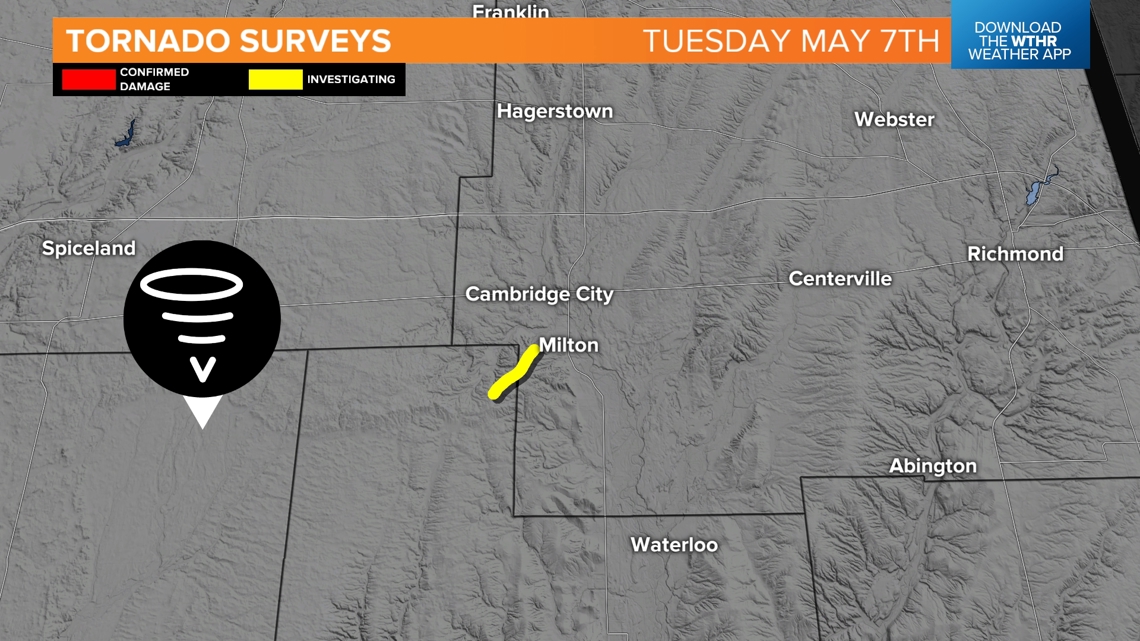
Crews will continue to look for tornado damage across Wayne, Fayette and Union counties. There is a chance more small, brief tornadoes touched down.
Tornadoes in southern Indiana
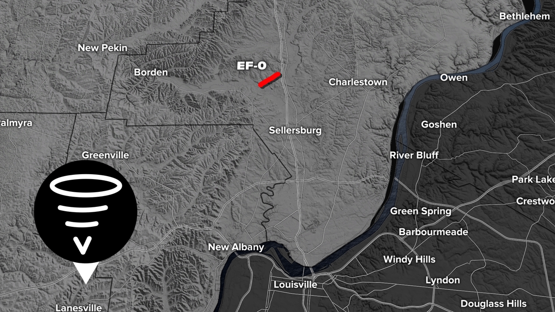
DECATUR COUNTY
- EF0 (peak winds 79 mph)
- Start time — 9:23 p.m., End time — 9:23 p.m.
- No injuries, no fatalities
- More details to come

Tornadoes in northern Indiana
STEUBEN COUNTY
- EF-Unknown
- Start time — 6:11 p.m., End time — 6:12 p.m.
- No injuries, no fatalities
- Path length: 0.04 miles
- Path width: N/A
- Details: There were several reports of funnel clouds NW of Angola. It looks like a brief tornado touched down in a field just west of W Landis Road. It hit and then dissipated without damage. The rating will remain unknown.
Other storm reports
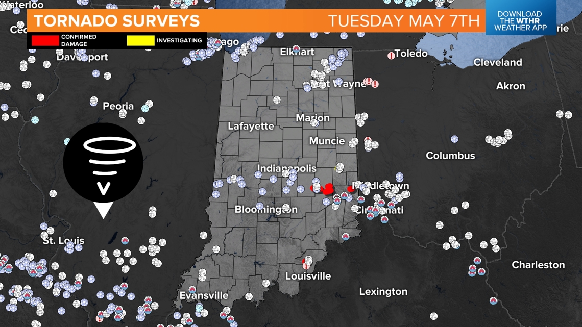
Tornadoes are not the only things to have caused damage. Many wind and hail reports came in from across the state.
For example, lots of trees were damaged along Fairview Road in Greenwood, Indiana. As the storm was rotating over Johnson County with a wall cloud, it could have briefly caused gusty wind or even a quick "gustnado."
This map shows all the hail, wind and flooding reports across the state.

Stay tuned. Surveys will come in throughout the week, increasing the total count for the state.
— 13News Meteorologists Angela Buchman and Matt Standridge

