INDIANAPOLIS — Severe storms are moving across Indiana as the remnants of Hurricane Beryl reach the Hoosier State.
8:37 p.m.: Severe storms reportedly caused heavy damage to a warehouse in Posey County in southwest Indiana. 13News affiliate WFIE reports damage to the Kenco Logistics facility, a large warehouse near Mt. Vernon. A viewer also shared a photo of a train that was tipped over by the storms in Mt. Vernon.
Ben Goebel shared video with 13News of an apparent tornado near Mt. Vernon Tuesday afternoon.
8:20 p.m.: A Tornado Warning was issued for parts of Franklin, Union and Fayette counties until 8:45 p.m. A thunderstorm capable of producing a tornado was located near Brookville, moving to the northeast at 30 mph.
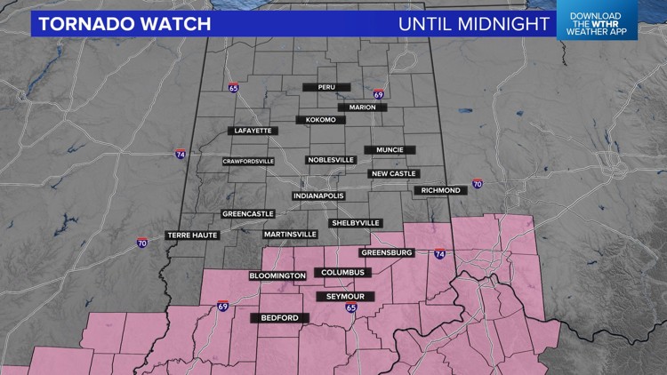
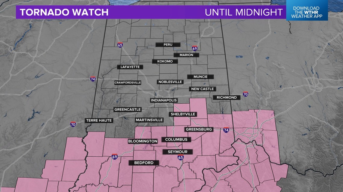
7:30 p.m.: A Tornado Watch is in effect for southern Indiana until midnight.
Central Indiana counties included in the watch are Bartholomew, Brown, Decatur, Fayette, Lawrence, Monroe, Rush and Shelby counties. This includes the cities of Bloomington, Nashville, Columbus, Greensburg, North Vernon, Seymour and Bedford, Shelbyville and Greensburg among others.
There are several storms developing south of Indianapolis at 7:30 p.m. These storms may rotate and contain damaging winds.

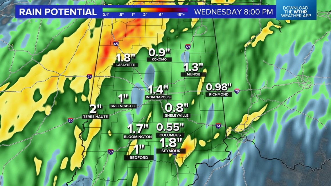
This threat comes as the remnants of Hurricane Beryl arrive in central Indiana. It has been a soggy day so far with that tropical moisture. Our concerns as we move into this evening center around more heavy rain causing flooding and that tornado threat.
Additional rainfall of 1-2 inches is possible and there is the elevated severe threat across the southern part of the state.


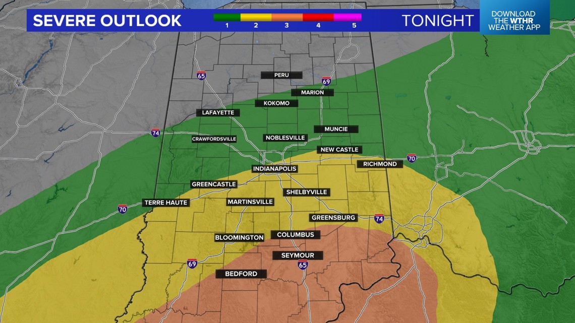
We expect the heaviest rain and the greatest threat of severe weather, including tornadoes, to take place between now and about midnight. That is the when. The impacts include flooding and damaging winds. What you need to do is have ways to get warnings even after you go to sleep tonight.
Make sure your cellphone volume is on so you can hear warnings if you are asleep.
After the severe threat ends, gusty winds will still be an issue into Wednesday. If you have a few extra minutes, it is a good idea to get the yard cleaned up, especially the things that can blow away in strong winds.
Stay with the 13 Weather Team for additional updates.