INDIANAPOLIS — Severe Weather Preparedness Week continues and today, we focus on those involved in the process.
You might often see us show maps created from the Storm Prediction Center, based out of Norman, Oklahoma. They create severe weather outlooks days in advance so we can prepare earlier.
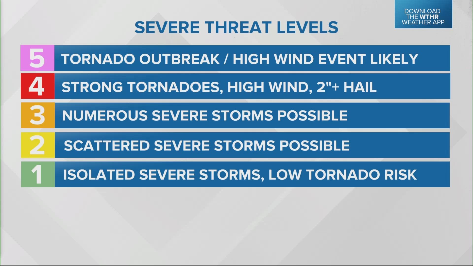
There are five threat levels, ranging from 1 to 5 based on storm intensity and coverage area.
The SPC is also responsible for issuing severe thunderstorm and tornado watches.
Our local National Weather Service office in Indianapolis issues warnings. Some of these warnings are based on radar, but others are issued based on reports from storm spotters — and they need more eyes on the sky.
If you are interested in learning more about storms, the NWS is now hosting storm spotter training sessions, where you can learn how to accurately relay reports to help in the warning process. This also helps emergency managers and first responders allocate resources faster.
There is a spotter session in Marion County Wednesday evening, and registration is required.
Information on all the sessions being held across central Indiana for the rest of the month can be found at this link.

