INDIANA, USA — Indiana picked up anywhere from a couple hundredths of an inch of rain to over 3 inches in spots. It has been feast or famine for rainfall totals across the state the past three days. Who got the most?
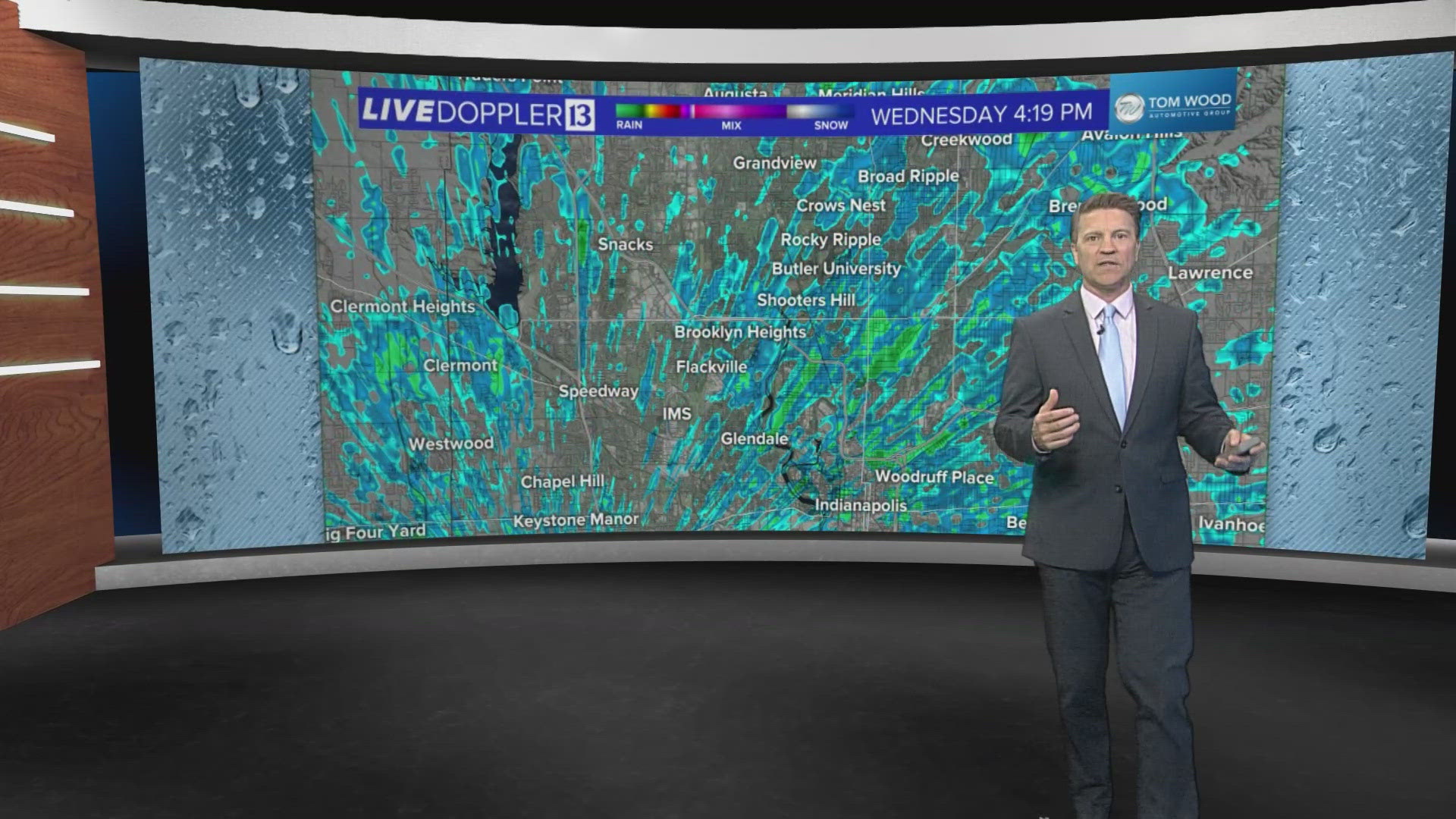
Tap HERE for our interactive radar to track the rain.
This spring has been wet. Drought conditions have been eliminated from the entire state of Indiana. The soil is good and wet. However, in some spots, we have flooding threats with some higher rivers and some areal flooding on farmland with new crops going in.
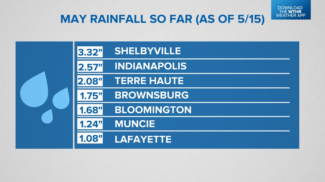
MAY RAIN STATISTICS SO FAR
In the month of May, we typically get 4.75 inches total.
- May 2024 so far: 2.57" (typically near 2.21" by May 15) +0.36"
- 2024 so far: 19.35" (typically at 15.79" by May 15) +3.56"
We are ahead for the year so far, but recently, the rainfall has trended more normal. This is our wettest season of the year. The big gains for rainfall came earlier this spring and late winter.
How much rain did we just pick up?
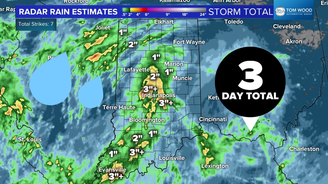
Multiple rounds of showers and downpours have hit Indiana the past few days. Some of us picked up a lot, while others only got light showers to just wet the ground. This map shows radar estimations across the state. Central Indiana and southwestern Indiana got the most with a good stretch of 1-3 inches, in some places even more.


For our biggest towns in central Indiana, these are the top reports coming from the National Weather Service.


Looking ahead
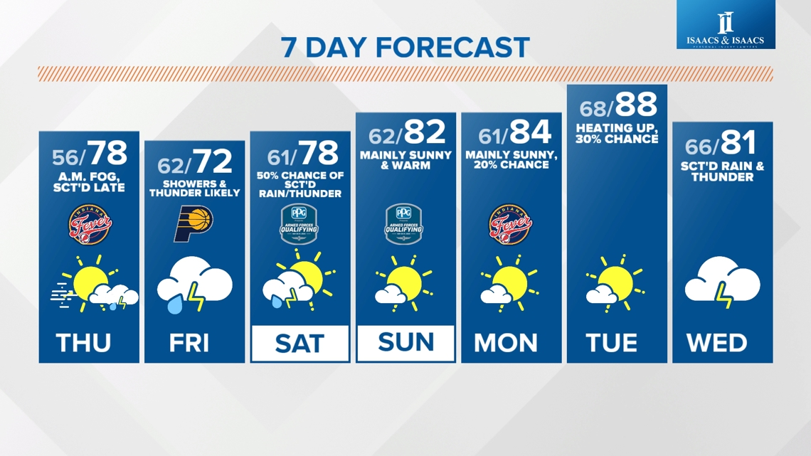
We have more rain chances on the way. Another round is likely Thursday evening into Friday. Spotty showers are possible Saturday during qualifications at the Indianapolis Motor Speedway.
Rain chances will continue on-and-off through Carb Day and race day for the Indy 500.
For more information on future rainfall forecasts, tap HERE.


