INDIANAPOLIS — Here we go. The forecast is playing out as anticipated so far. After a "lull" in snow coverage, radar shows an expanding area of moderate to heavy snowfall spreading northeastward into the state.
Remember, the bulk of accumulation and greatest impacts to travel from this storm occur from now until midnight. Snow rates of 1"-2" per hour cause rapid deterioration of roadways and make travel impossible in some locations. We're advising people to avoid travel by 3 p.m. unless absolutely necessary. If you must travel, please take a shovel, blankets, food, and water in the event you become stuck in snow.


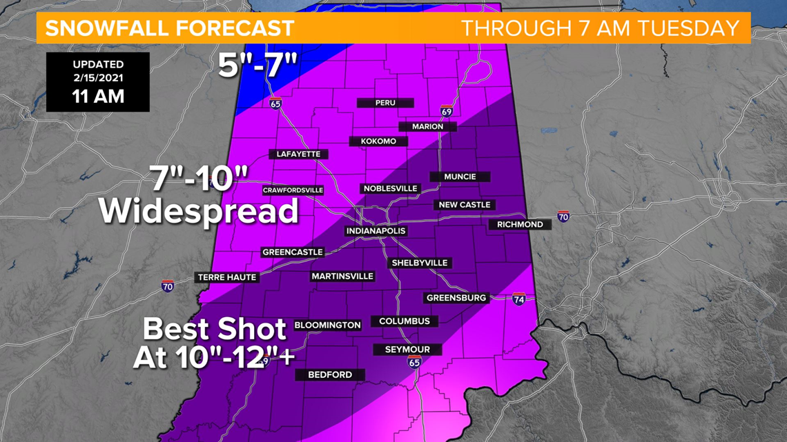
The entire region gets hit with 7"-10" snow with an area of potentially higher amounts (10"-12"+) from near a line of Evansville-Indy-Muncie. It's very possible Indy gets just its 8th day of 10"+ snowfall on record since 1871.
Either way... dangerous travel conditions are likely with blowing and drifting continuing overnight with gusts of 25-35 mph creating near-whiteout conditions.
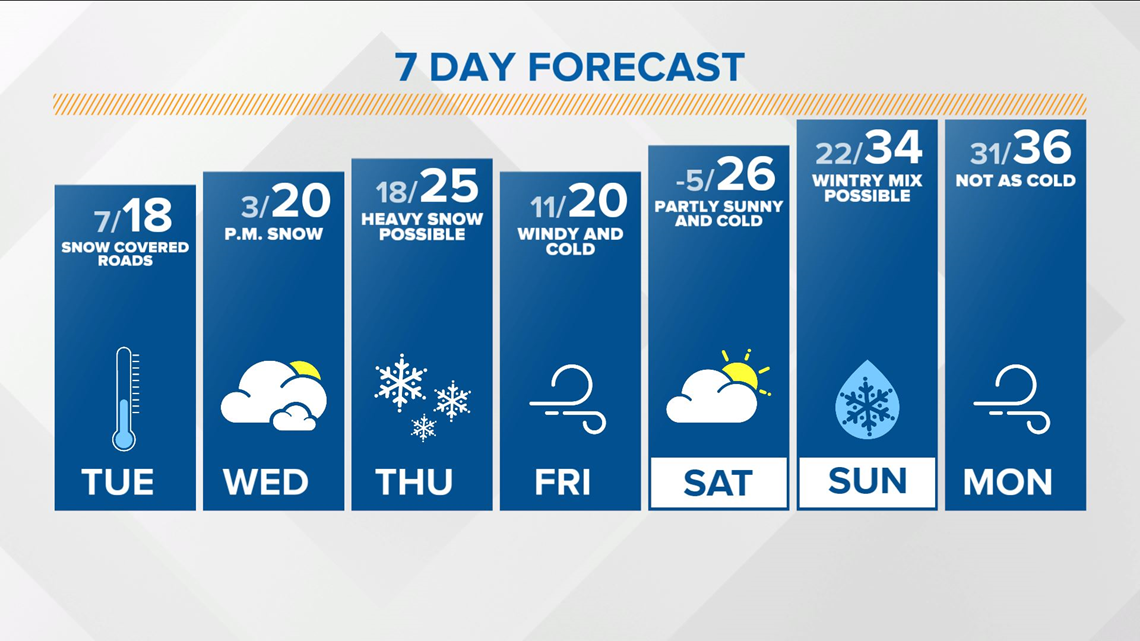
Snowfall is mainly over just after midnight but expect treacherous driving conditions well into the Tuesday.


