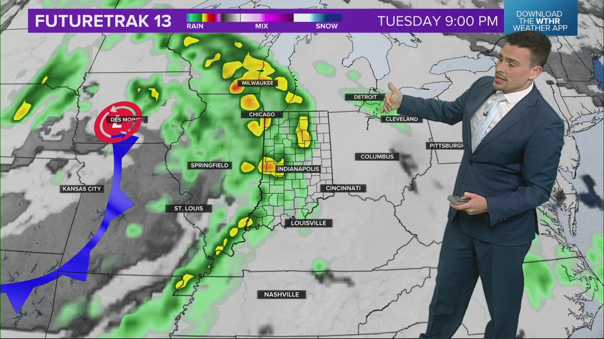
INDIANA, USA — Storms are on the way again for Indiana this week (April 15-19) as two cold fronts move in. If only we could keep the warm, sunny weather from the weekend! Some severe storms are likely to arrive from the central Plains Tuesday and Wednesday. Tuesday night may have the strongest storms for Indiana, but there are a couple other rounds to watch as well.
Tap HERE for our interactive radar to track the incoming storm system out west.
Indianapolis hit 80 degrees for the first time this year on Sunday! Many 80s were reported across the states. Even some humidity started to come back. Now we will watch two cold fronts take advantage of this warmth to squeeze out some rain and storms.
Right now it looks the best uplift in the atmosphere to support severe storms this week will be west of Indiana, but we will still have the chance for severe storms here as well.

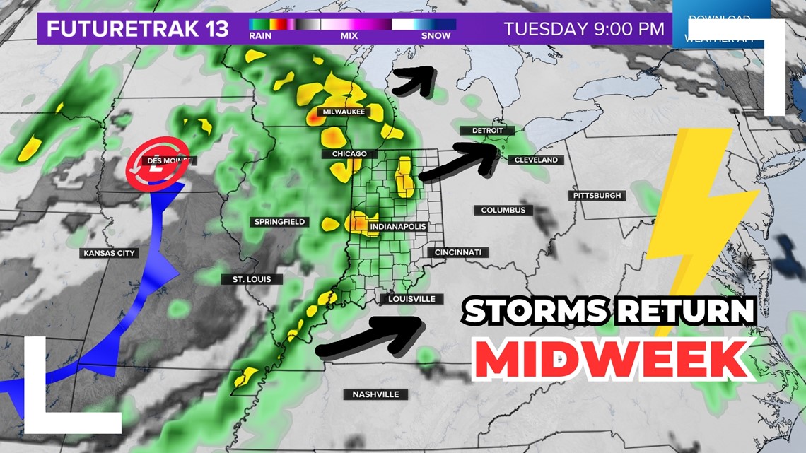
When should we expect rain and storms?
There will be multiple chances for rain and sometimes storms with the next low pressure system. In fact two cold fronts are expecting.
- Wednesday — this one has the highest chance for severe weather, especially Tuesday night into Wednesday morning
- Friday — this one may bring scattered rain and rumbles, hard to say if there will be a severe threat yet
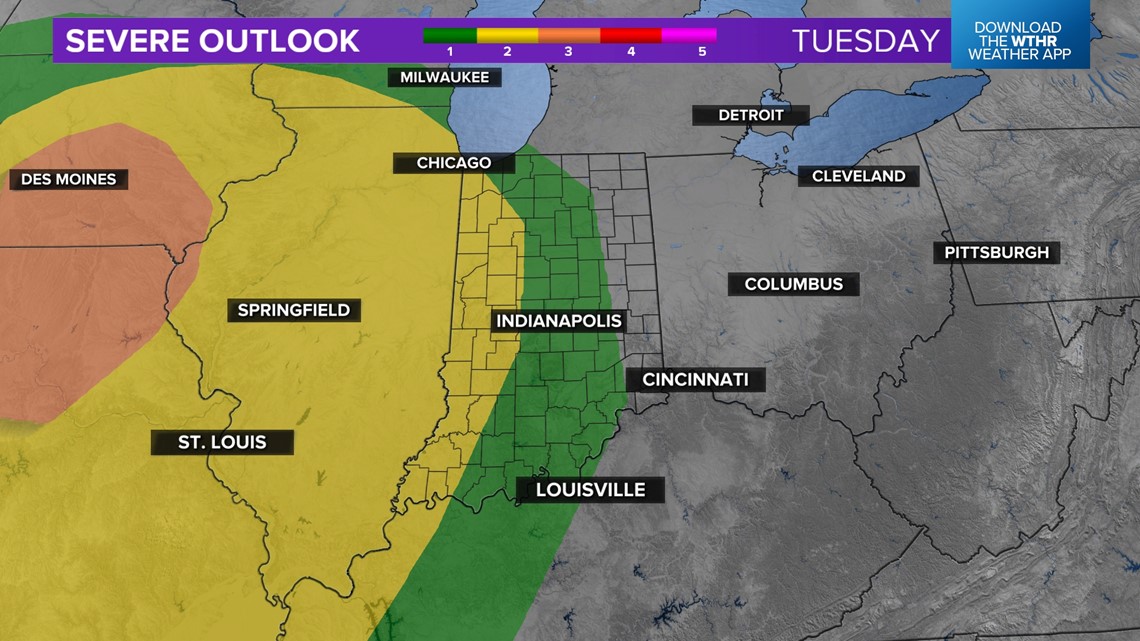
The first push of energy will be Tuesday and Wednesday. Expect scattered rain and thunder Tuesday, with a bigger push of rain and storms moving in from Illinois to Indiana sometime after sunset on Tuesday. That night has severe threats for Indiana, especially west of Indianapolis.
(Note: These severe zones will change over time. Tap HERE to see the latest severe forecast.)

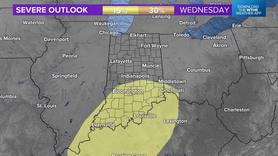
Once we get to Wednesday, we'll see how much we can recover from the previous night's storms. If we can warm up again, there may be more storms Wednesday afternoon as the actual cold front finally moves in. The highest chance for storms may be closer to the Ohio River where less rain may fall the night prior.

How much more rain is coming?
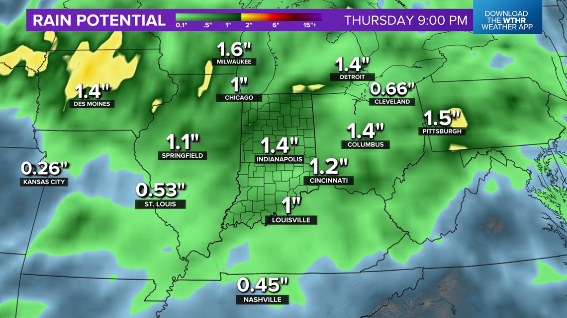
We don't need anymore. Not everyone will get a severe storm with wind, hail, or an isolated tornado, but everyone should pick up more rain. We already have 150% of rainfall an average April brings to central Indiana. Rivers are still high.
Expect another inch or so across the state. This system may not drop as much as the last one. The most intense cells and rain bands will drop more in localized spots.

What about the rain chance later in the week?
There may be more showers on Friday, maybe even a possible rumble of thunder. That one is still a few days out and we need to watch this first system. The angle of attack with the front and the best uplift in the atmosphere to support rain is still uncertain. Expect scattered showers Friday before more days of dry weather this coming weekend and next week.
— 13News Meteorologist Matt Standridge

