

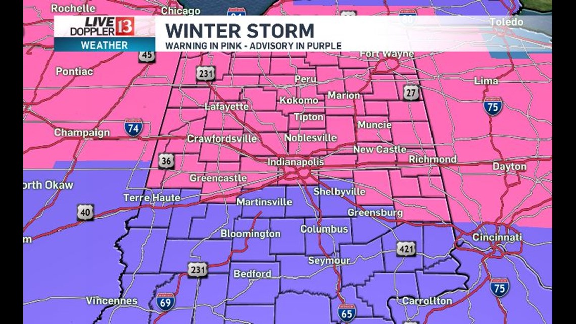
The Live Doppler 13 Weather Team continues to track a developing winter storm. The storm will bring rain, sleet, freezing rain and snow to central Indiana. This wide variety of precipitation type is what makes the snowfall forecast so difficult. Here is the latest from the National Weather Service. The counties in pink are under a winter storm warning and the counties in purple are under a winter weather advisory. We are still waiting for an update for a few of our eastern counties. You can expect the higher snow totals in the warning area.

For now, we are keeping it all snow from Lafayette to Tipton to Kokomo and Marion and cities north of that line. In this area, we are forecasting 4-6 inches of snow. Along and just north and south of I-70, we are forecasting a mix of snow, sleet and freezing rain. In this area, we are forecasting snowfall potential of 5-8 inches on top of some minor ice accumulations. Those areas that have less mixing will be on the high end of the 5-8 range and those ares with more mixing will be on the lower end of the range. Across our southern viewing area, this may start as rain before changing to a wintry mix and then to snow. We are forecasting 3-5 inches of snow in this area. In order to get this range, there will need to be a band of heavy snow on the back side of the storm on Saturday evening. It is also this back side band of heavy snow that may bring a few areas in east central Indiana into an 8"+ total.

This system is still developing and there will be changes maybe hour by hour based on what we are seeing on Live Doppler 13 Radar on Saturday.
There is still high confidence on timing. This winter storm will impact central Indiana from 4am Saturday through 4am Sunday. We also have high confidence in gusty winds developing on Saturday and much colder air arriving Saturday night. Winds will gust 30 to 40mph + Saturday afternoon through Sunday morning. Temperatures will fall into the teens late Saturday night and into the single digits by Sunday morning. Sunday and Monday will be dangerously cold, with temperatures by Monday morning dropping below zero and wind chills nearing -30 Sunday into early Monday. Remember your pets when it gets this cold. Your family, friends and home may need some extra attention too.