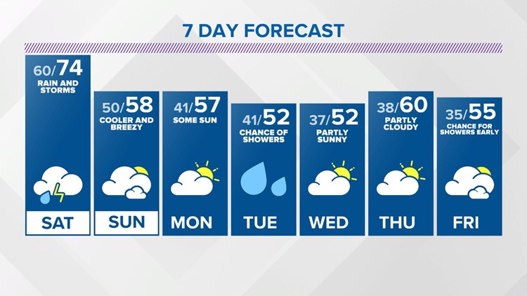
Temperatures were as warm as the 70s today across the southern part of the state. Where we were stuck in the rain today, temperatures were cooler. That warm air to the south will push north over the next 24 hours. Along the boundary of that warm air there will be another round of rain and storms developing tonight. We are forecasting those to develop around 9pm and continue off and on through at least early Saturday morning. There will be a few dry hours on Saturday and it will be warm and breezy, with temperatures in the 70s.
We will be watching for another wave of storms later Saturday. The initiation of these storms will be across Illinois where there is unfortunately a higher risk for severe weather including tornadoes. All modes of severe weather are possible here too and we will be tracking those storms that develop in Illinois closely. Saturday will b e a day to stay weather aware.
This storm system moves out for Sunday. Sunday will be breezy and not as warm, with afternoon temperatures in the upper 50s.
Monday and part of Tuesday will be dry, with highs in the upper 50s on Monday and in the lower 50s on Tuesday. There is a chance for showers on Tuesday. There will be some dry time on Wednesday and Thursday next week, with highs in the 60s back by Thursday.


