
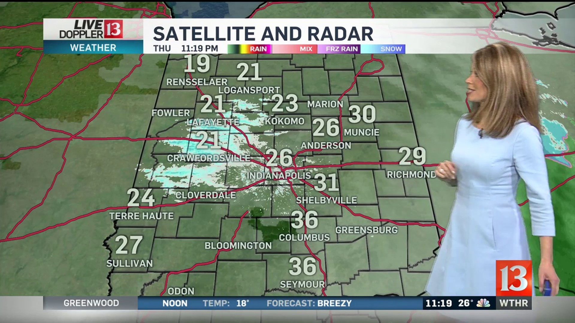
2 day rain totals to 2-5+ inches caused flooding on Thursday. Street flooding will slowly improve but expect rivers, creeks and streams to run high for several days at least. From flooding to freezing. Weather issue number 2 is the temperature drop. Temperatures will drop from the 50s into the teens in less than 12 hours. This is fast enough and a big enough drop for a flash freeze. This means the potential for some slick roads early Friday. We are forecasting teens Friday morning, with wind chills below zero. Gusty winds have also prompted a wind advisory. That wind advisory is in effect until 7am Friday. There is some sunshine in the Friday forecast, but temperatures will only reach the lower 20s during the afternoon hours. It will be a chilly Saturday, with some sunshine. Saturday afternoon temperatures are forecast in the lower and middle 30s. Sunday will be a few degrees warmer and in the upper 30s to near 40 degrees. There is a chance for some light snow or a light wintry mix later in the day Sunday. Central Indiana gets on the milder side of an active weather pattern early next week. This will mean the chance for a few showers on Monday and Tuesday. |
Live Doppler 13 Weather Forecast - 2/7/19 Evening Update
Any water left standing will start to freeze overnight, as temperatures fall into the teens. Friday will be breezy and much colder.