
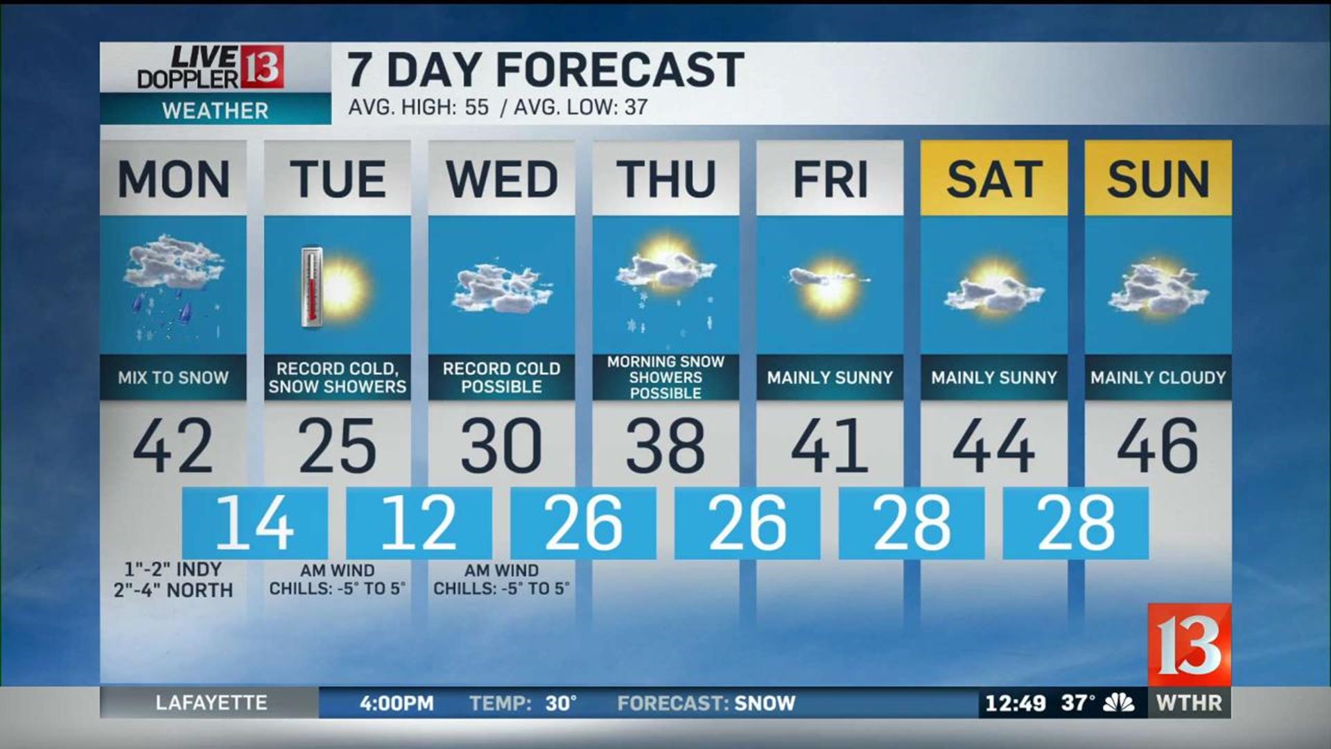
Snow is in the forecast for the rest of this evening. The highest accumulations will be north, with 2-4 inches of snow possible. Most of central Indiana will be in the range of 1-3 inches. Unfortunately the snow will be steadiest during the evening drive. In addition to the steady snow, temperatures will fall fast enough for roads to quickly become slick and some areas snow covered. Temperatures will fall into the teens and in fact we don't make it out of the teens on Tuesday. A gusty north wind will bring wind chills to near zero early Tuesday morning. That gusty wind will also trigger lake effect snow squalls. These develop quickly and cause reduce visibility and snow covered roads. Travel with extra caution if you run into one of those on Tuesday.
These frigid conditions continue into Wednesday, with morning temperatures near 10 degrees and afternoon highs only near 30. The rest of the week will be quiet, as we track a gradual warming trend back into the 40s by Friday.