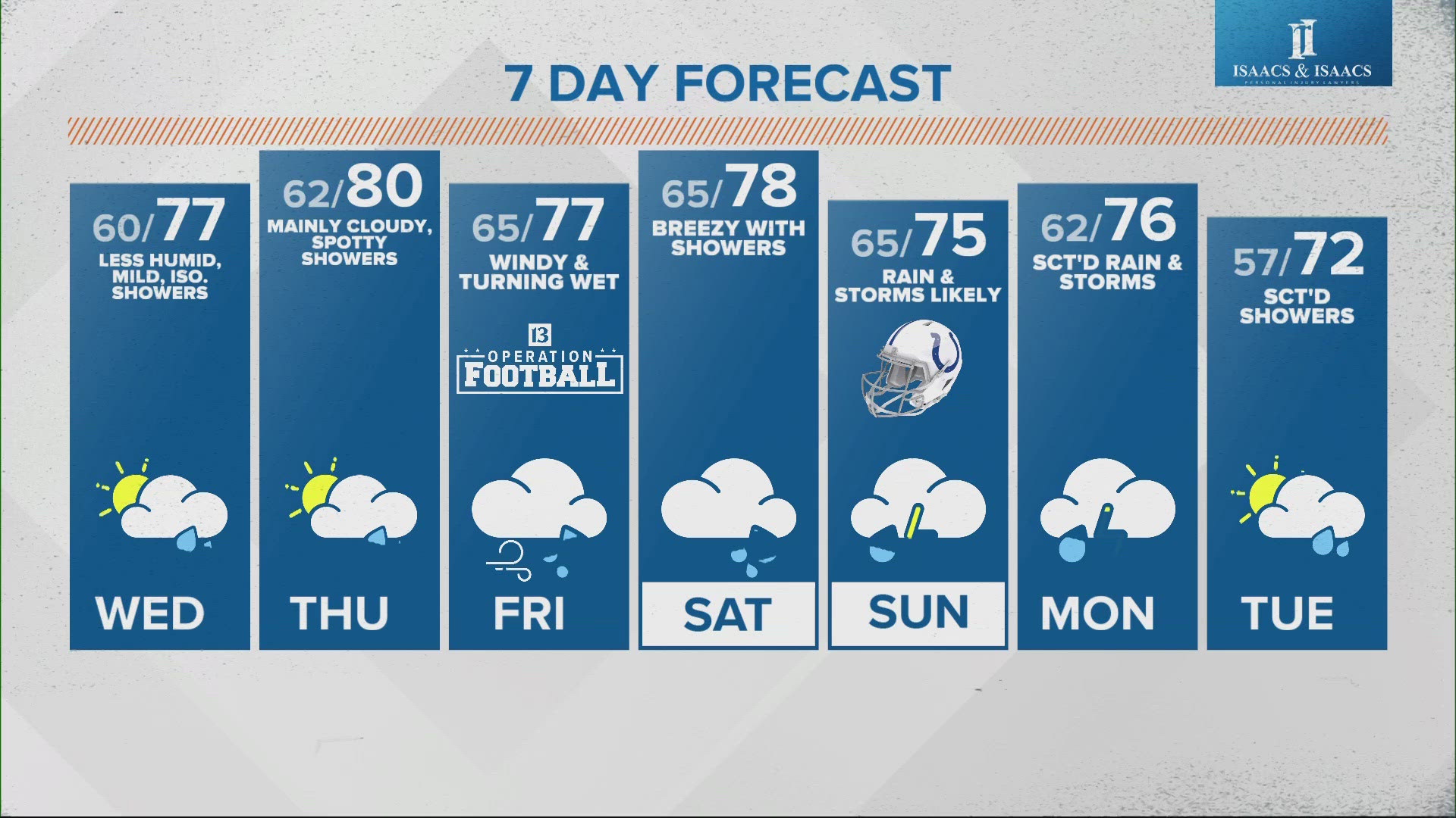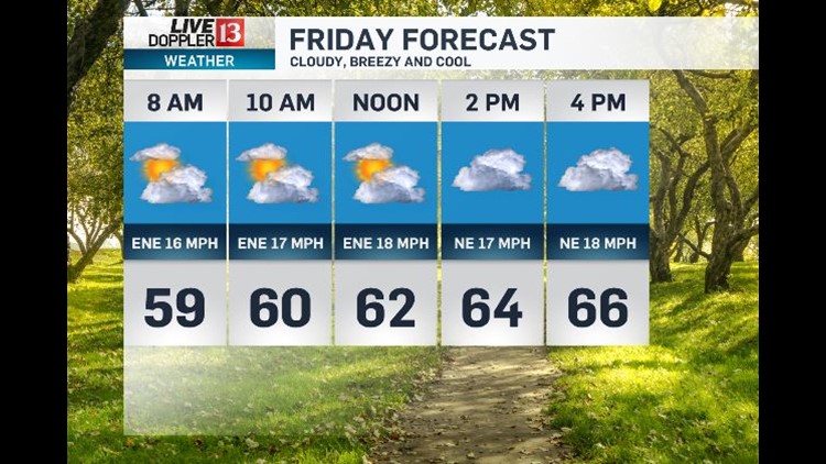
Friday might be a bit of a shock. It will be cloudy, breezy and cool. High temperatures will only be in the 60s. Winds will be NE near 20mph with some higher gusts.
What is left of Harvey will be spinning to our south Friday and early Saturday. There will be some rain across SE Indiana Friday night. The chance for rain will linger from about Indianapolis south and east through Saturday morning. The highest rain totals will be an inch or 2 from Richmond to Greensburg to Columbus and Seymour. .25" to .50" will be possible from Muncie to Indianapolis to Bloomington. Areas north and east of Indianapolis won't get much if any rain.
As Harvey moves east, skies will clear Saturday afternoon and evening. Highs on Saturday will be in the 70s.
80 degree warmth is back for the rest of the holiday weekend including Sunday and Labor Day.