
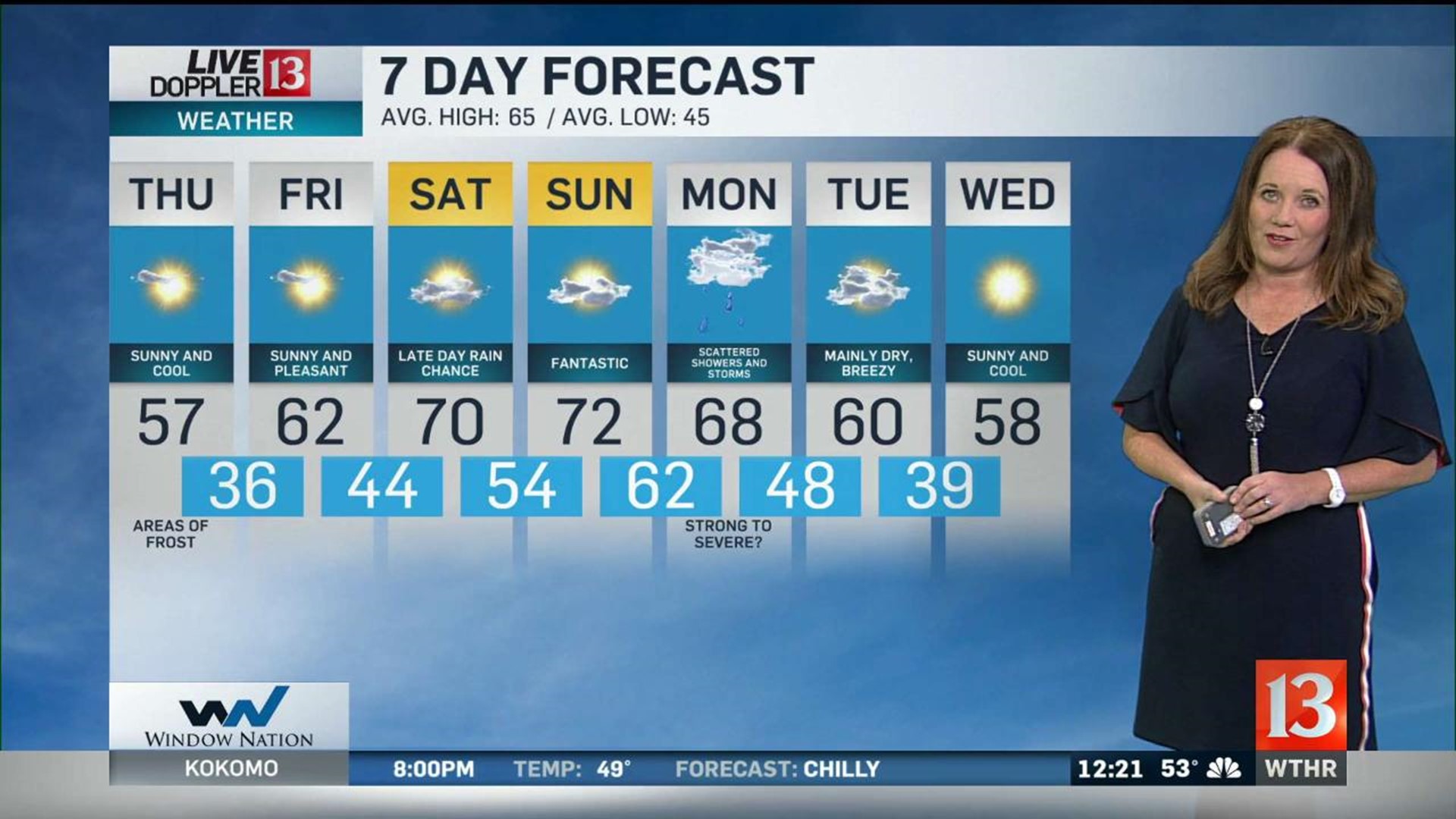
It was a clear and cool start this morning with some patchy frost. It will be cooler than average today but it will be brighter and less breezy than yesterday. Afternoon highs will climb into the mid to upper 60s.
It will be clear and cool tonight with temperatures falling into the mid 30s by morning. A Frost Advisory is in effect for north central Indiana from 2am through 9am Friday, with areas of frost likely.
There will be a terrific rebound by Friday afternoon with highs in the low 60s.
The warming trend continues through the weekend. Saturday will be mostly sunny with highs near 70°.
A weak cold front will move in by Saturday evening. Clouds will increase with a chance of a scattered shower. Any rain will move out by early Sunday morning.
Sunday will be a terrific October day with partly sunny skies and highs in the low 70s.
Another front will arrive on Monday. This will bring scattered showers and thunderstorms to central Indiana from early morning into the evening. A few storms could be strong to severe.
A gradual clearing moves out on Tuesday with breezy winds and sunshine by afternoon.