
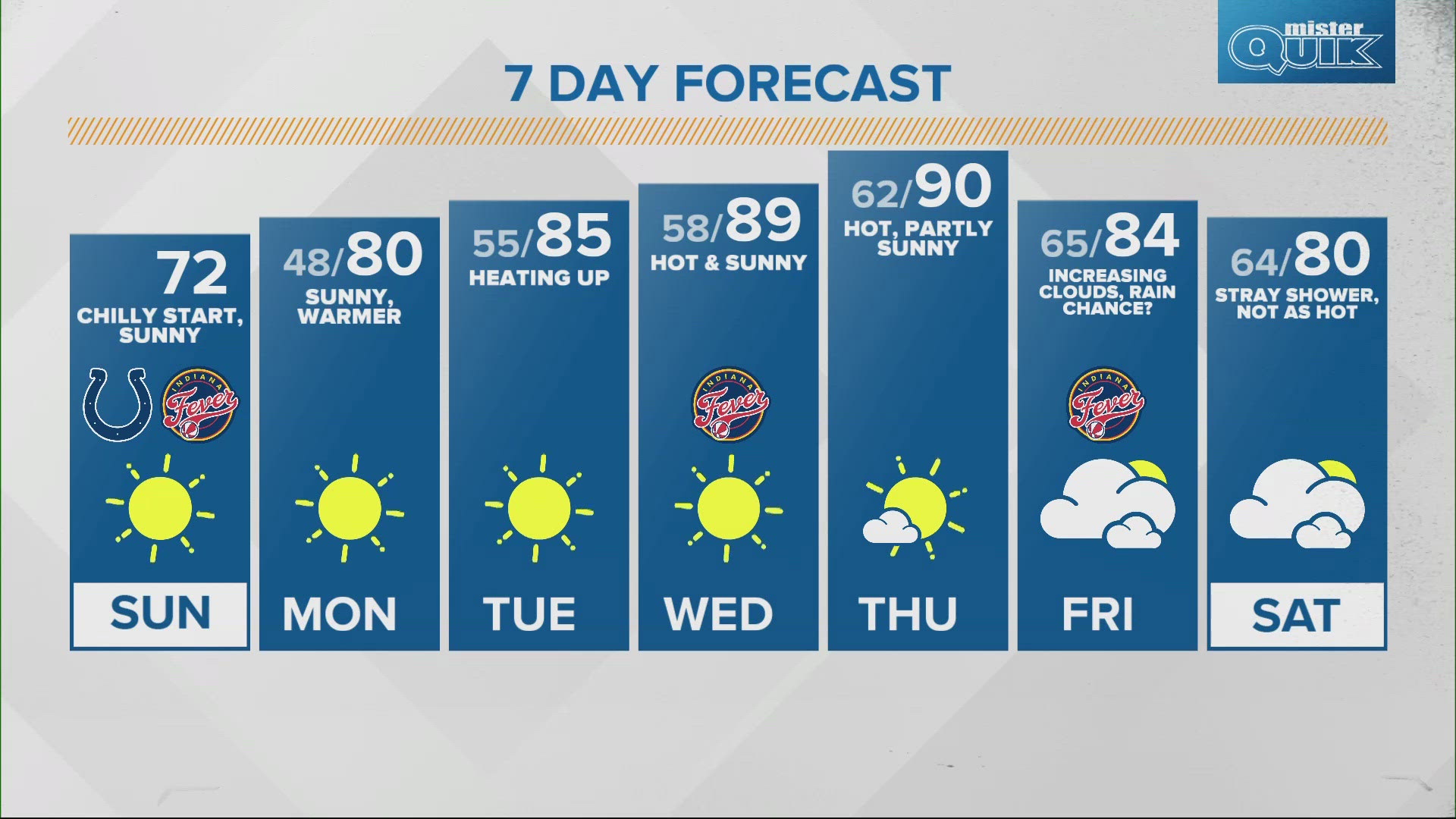
INDIANA, USA — After an unseasonably chilly start in central Indiana with outlying locations in the 30s, we'll see a nice warming trend after highs only topped out in the upper 60s on Saturday. Today, temperatures rebound into the low 70s under a sunny sky. The average high for this time of year is in the low 80s.
Temperatures will begin to trend back upward starting tomorrow with highs near 80 degrees. A dome of high pressure remains in control for the next few days keeping the skies clear. As this high pressure core shifts east of central Indiana, winds will begin to shift to the south pushing in warmer air.
Highs will be back in the mid-80s on Tuesday and near 90 for Wednesday and Thursday. With a combination of no rain and low humidity levels, we'll see a slightly elevated fire danger during this hotter streak.
The next time we see rain looks to be dependent on a developing area of low pressure in the western Gulf of Mexico. Only a slight chance of showers is in the forecast for now but with increased cloudiness and cooler wind, temperatures will cool back off starting Friday and into next weekend.