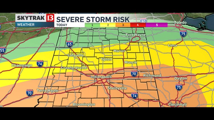
The Storm Prediction Center has placed the Indianapolis metro area and the rest of southern Indiana under an Enhanced Risk of severe weather later today. Severe thunderstorms potentially capable of damaging winds, tornadoes, and hail are forecast for Indiana this afternoon and evening. Today will be a day to stay weather aware, due to that threat for sever weather.
We will see rain and thunderstorms this morning, but between 2 and 9 p.m. storms will fire up over the area. That’s the timeline for the potentially severe weather. On the severe weather scale from 1 to 5, most of central Indiana is at a 3 or a slight risk for severe storms.
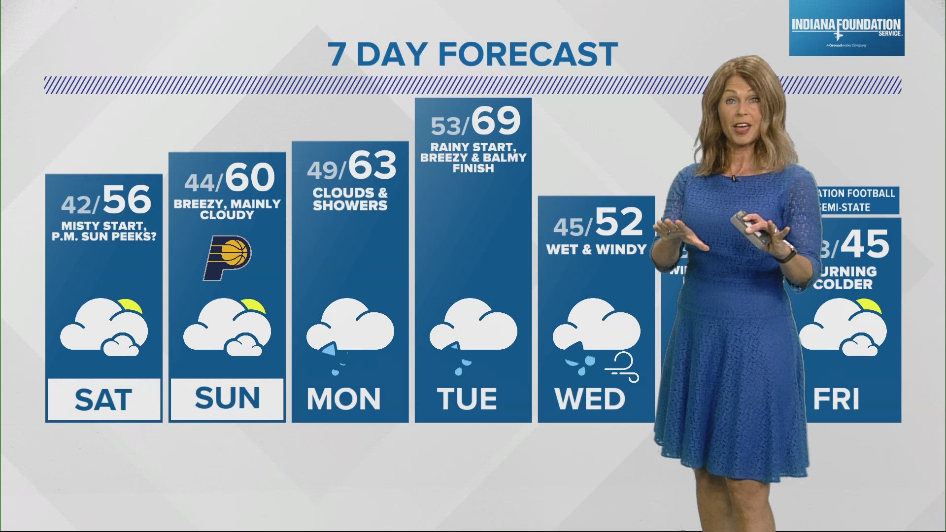
Right now, it looks like the storms may come in a couple of waves. The timeline for the first wave is early in the day Thursday. This first round will end by early afternoon. Another round of rain and storms will be possible during the afternoon rush hour into the evening. This means you may have a few dry hours Thursday afternoon. High temperatures will be in the range of 65 to 70 degrees.
Central Indiana gets on the cooler side of this weather system on Friday. High temperatures will only reach the 50s. Friday looks damp too, with scattered showers.
Sunshine is still in the weekend forecast, with highs in the upper 50s on Saturday and in the 60s on Sunday.