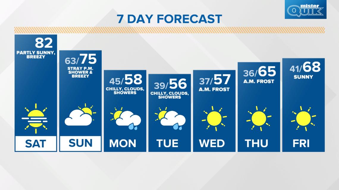
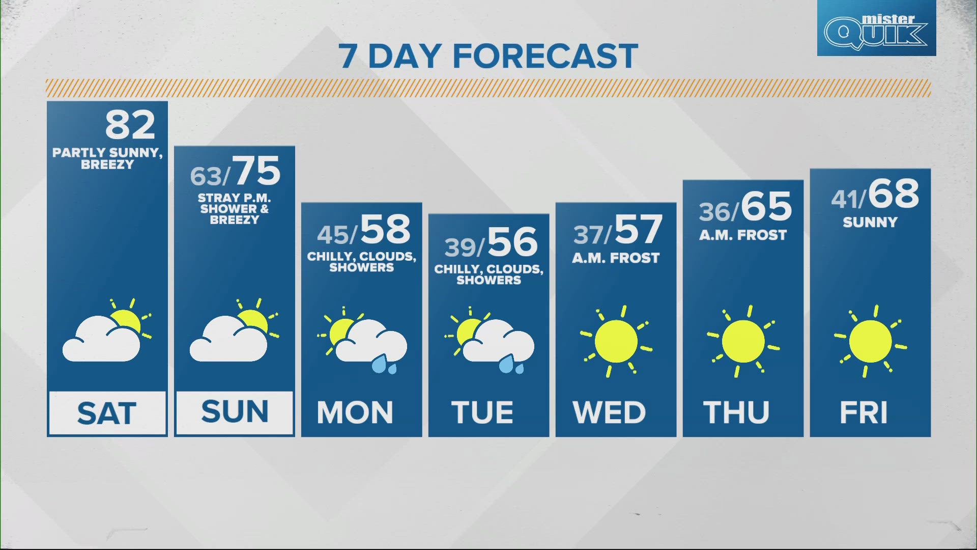
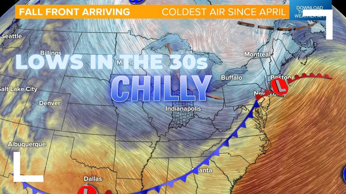
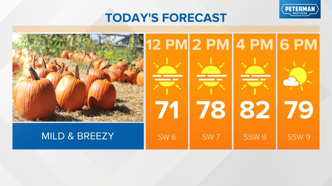
INDIANAPOLIS — Enjoy the warmth while you can. Our mild air continues today, with highs in the low 80s, but a much colder snap arrives Monday.

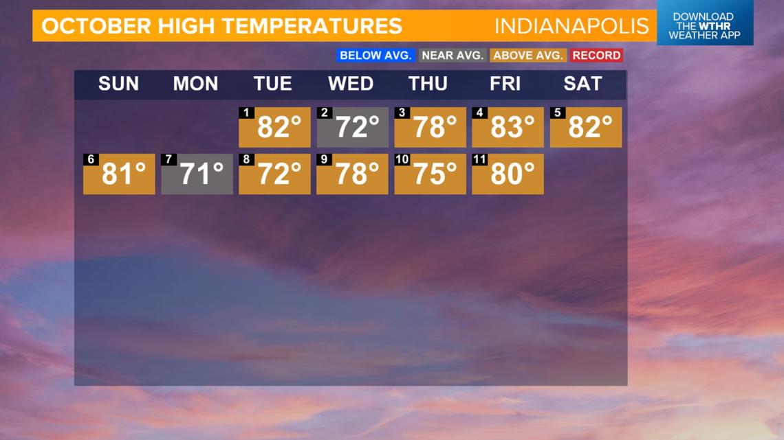
It's been a warm start to October
Through the first 11 days, every day has been at or above average (high temperature). With an average high of 77.6 degrees, this ties for the 9th warmest starts to October in Indianapolis on record.

Last day in the 80s in the extended forecast
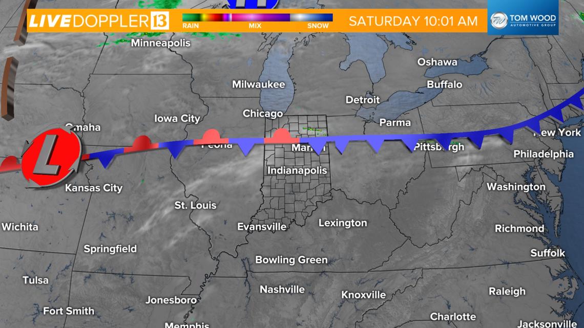
- A cold front will stall in northern Indiana and will prompt a few showers or thundershowers in the area
- Central Indiana will be on the warm side of this front pushing highs into the low 80s
- There will be some increased clouds and gusty southwest winds up to 20 mph


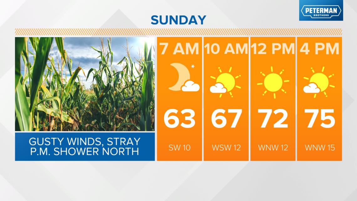
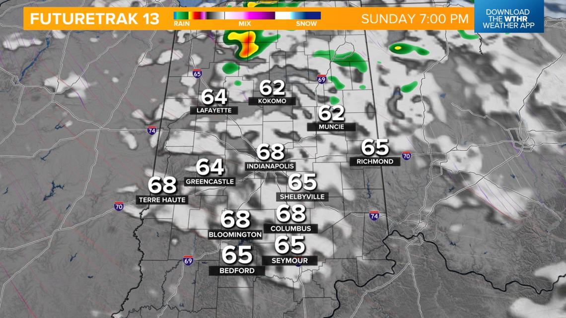
Sunday will be the transitional day with cooler air returning
- Boundary stalls overnight will keep a few clouds around with more mild lows in the low 60s
- It will be dry with some sunshine in the afternoon
- It will be breezy with 30 mph wind gusts and highs in the mid 70s
- There will be a few showers/thundershowers in north/northeastern Indiana Sunday evening


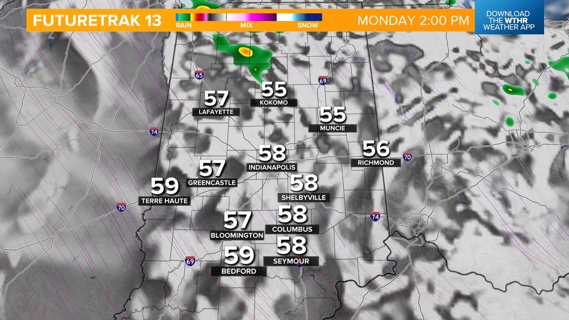
First frost on the horizon this week
- Temperatures will drop into the mid 40s by Monday morning with highs only in the upper 50s
- We'll keep clouds around with a few stray showers both Monday and Tuesday

Sunshine returns Wednesday, but clear skies will also allow temperatures to drop into the "frost" zone with lows in the mid to upper 30s both Wednesday and Thursday mornings.

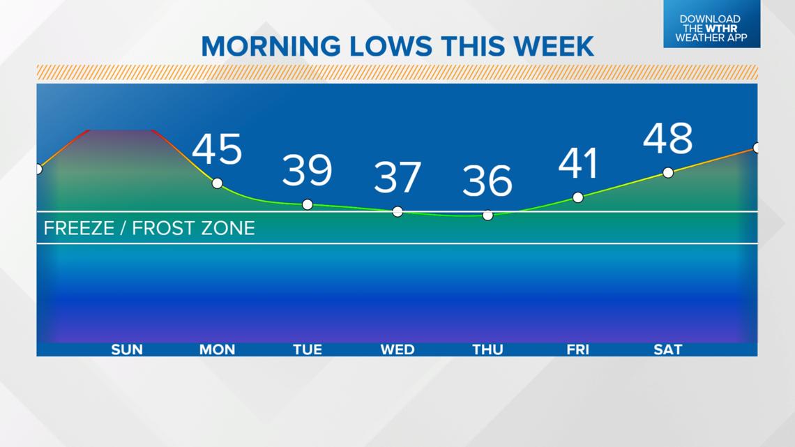
Temperatures will start to moderate by late week with highs back to more seasonal levels in the mid to upper 60s. Longer range forecasts are looking at temperatures remaining more seasonal or staying above average.