
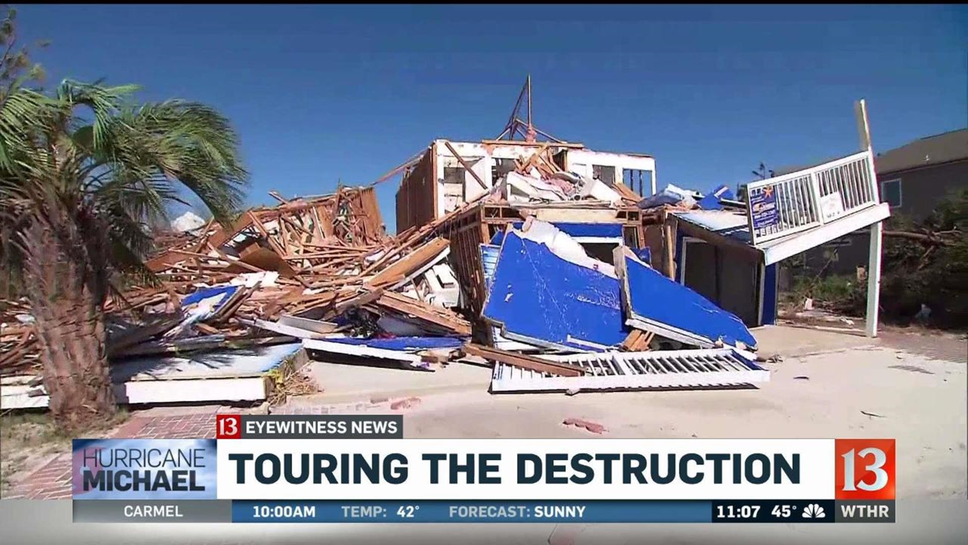
MEXICO BEACH, Fla. (WTHR) - Satellite imagery released by Thursday show the widespread and heartbreaking damage caused by Hurricane Michael to towns along Florida's Gulf Coast.
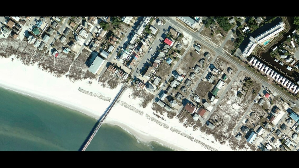
The National Oceanic and Atmospheric Administration posted layered maps focusing on Mexico Beach, Florida. One map shows the town before the hurricane struck.

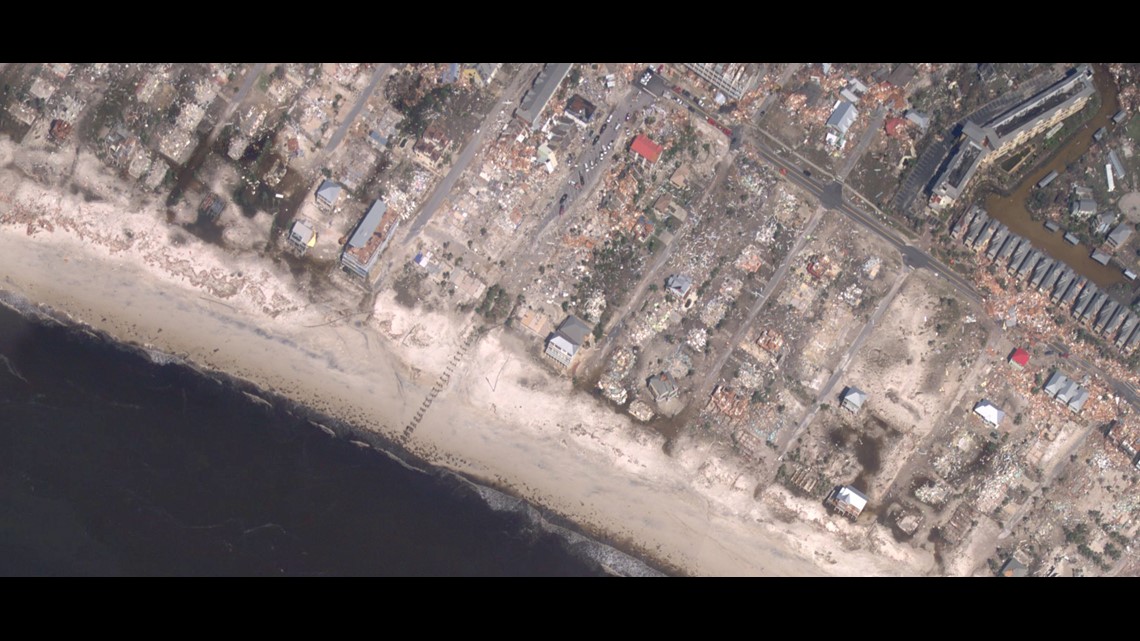
But a second image, taken the day after Michael made landfall with a direct hit on Mexico Beach and Panama City, shows homes and businesses destroyed and wide swaths of forest leveled. Some have described the damage as "apocalyptic."

To explore the map below, click the "layers" icon in the top right corner of the map to switch between the before and after image. You can also use the icons in the top left to zoom in and out of the image. Click here to open the map in a new window.