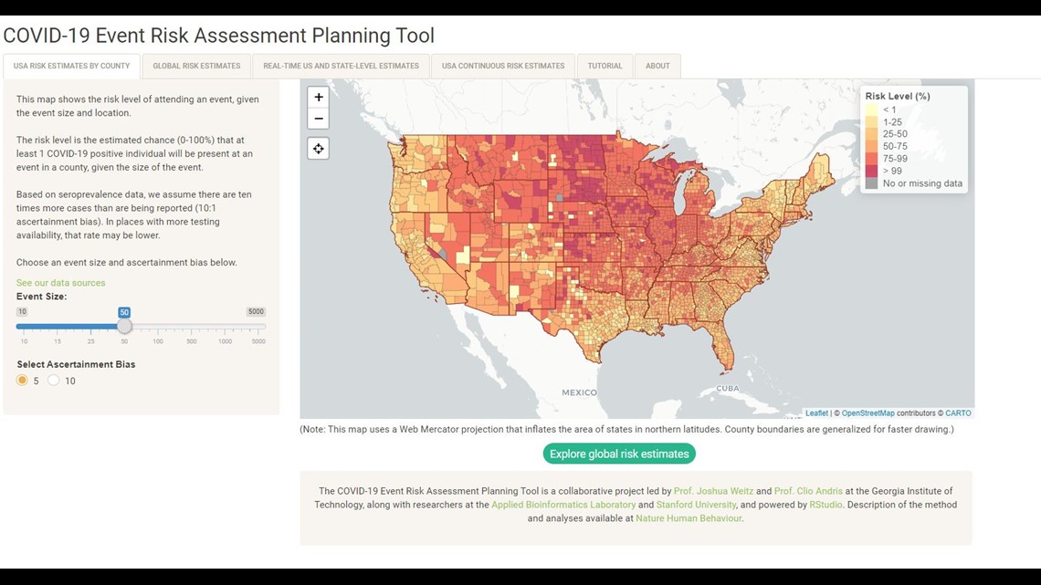
INDIANAPOLIS — Leaving town for the holidays or gathering with family? A new interactive tool developed by a team of researchers at Georgia Tech can give you a real-time analysis of how likely you are to catch COVID-19 at a party or event.
The COVID-19 Risk Assessment Planning Tool compares the number of cases per capita in any county across the country and uses the size of the event to give you a risk level.
The map is designed to help event planners, policymakers and just about anyone else.
You can change the event size from 10 guests to 5,000.
For example, if you were invited to a Thanksgiving dinner with 25 people in Marion County, your risk would be 52 percent, based on the current data. But if you switch the location to Chicago, there is a 71 percent chance someone will have the virus at the dinner.


On Wednesday, Indiana leaders announced new restrictions for large gatherings, effective Sunday. In “orange” counties, gatherings are capped at 50 people and 25 people in “red” counties.
Since many cases are not reported, the tool does assume there are 10 times more cases than reported. In places with more testing available, the rates are lower.
Researchers update the map daily with new data, which means the current number could change before the holidays as the number of cases grows across the country.

