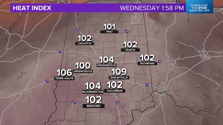
INDIANAPOLIS — A dangerously hot afternoon is in progress over all of central Indiana with heat indices of 100°-105°+ from now until 5-6 p.m.
We urge you to listen to your body if you must be outside for extended periods of time. Hydrate, seek shade and/or A/C, and take breaks when you can.
We discussed the uncertainties and complexities of our storm potential today.
It's becoming a little clearer now that the atmospheric "cap" (warm air aloft suppressing vertical motion/storm development) is holding strong for now.
This feature very well could hold all day and prevent any storms from occurring in central Indiana.

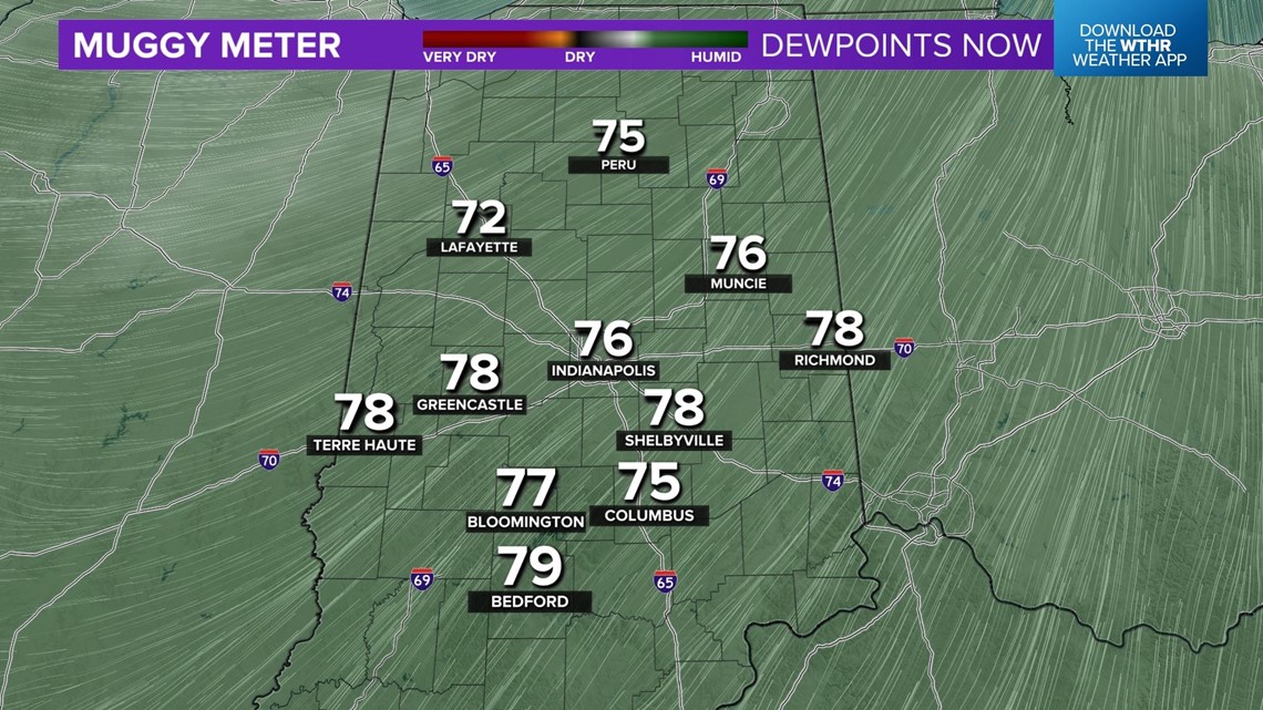
However, potential storm energy (CAPE) continues to grow underneath that layer within the hot and very humid air. This means that any storm that does develop will intensify rapidly and possibly become severe in less than 30 minutes after initiation.
For now, we believe the better chance of storm development will be east of I-69 and more likely closer to the Indiana/Ohio border.

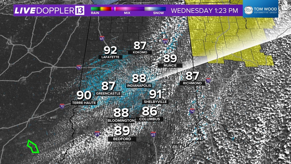
A Severe Thunderstorm Watch is up in NW Ohio into eastern Michigan, where there's a much better lift to bust the cap.
Stay Weather Aware and monitor radar, but I wouldn't expect much for your lawns, gardens, and farms at this time.
Any threat of storms will be over by 8 p.m. and slightly less humid air arrives overnight into Thursday.
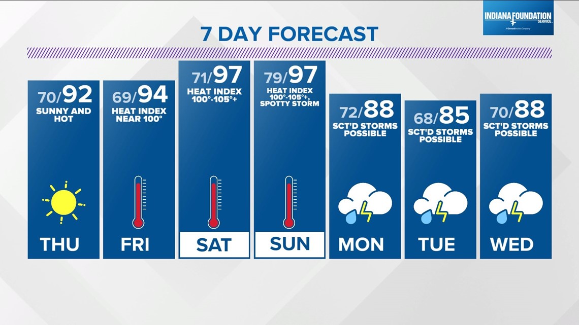
Though less humid, Thursday will be equally as hot or hotter with highs in the 90s. We'll stay in the 90s Friday and the Muggy Meter climbs again this weekend to produce another round of heat indices in the 100°-105°+ range.

