
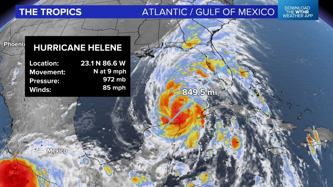
INDIANAPOLIS — This is the latest from the National Hurricane Center on Hurricane Helene.
As of 11 p.m. Wednesday, Helene has winds of 85 mph and is 425 miles southwest of Tampa, Florida. Landfall in the big bend area of Florida is expected Thursday evening. This is a large storm, more than 800 miles across.

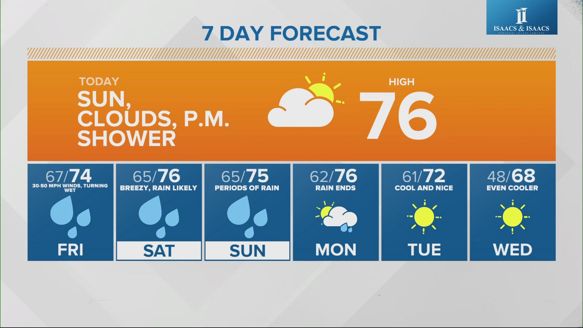
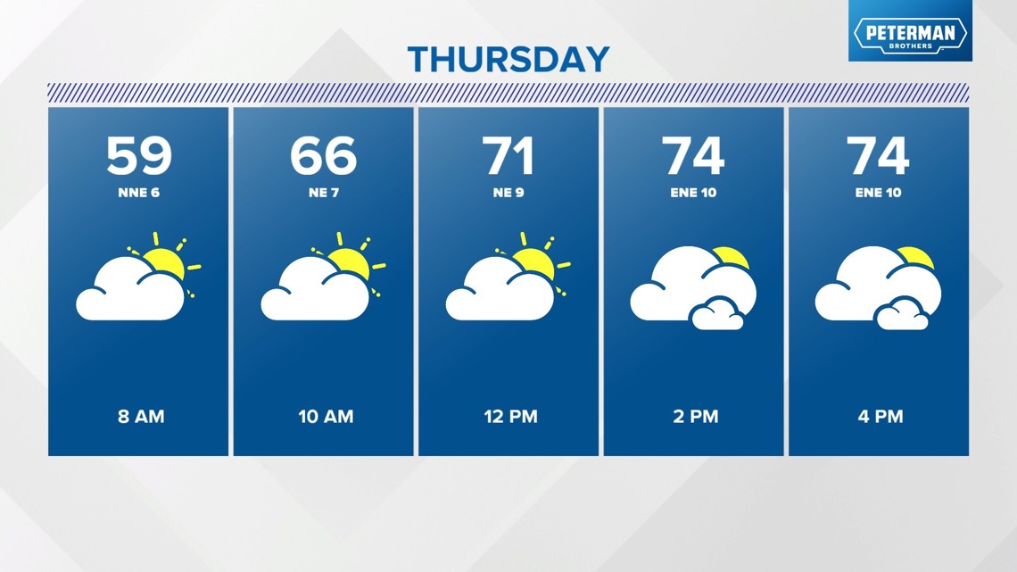
In Indianapolis, overnight temperatures will drop into the upper 50s and lower 60s. Forecast highs are in the range of 75 to 80 degrees on Thursday. A stray shower is possible, but most of the area will be dry.

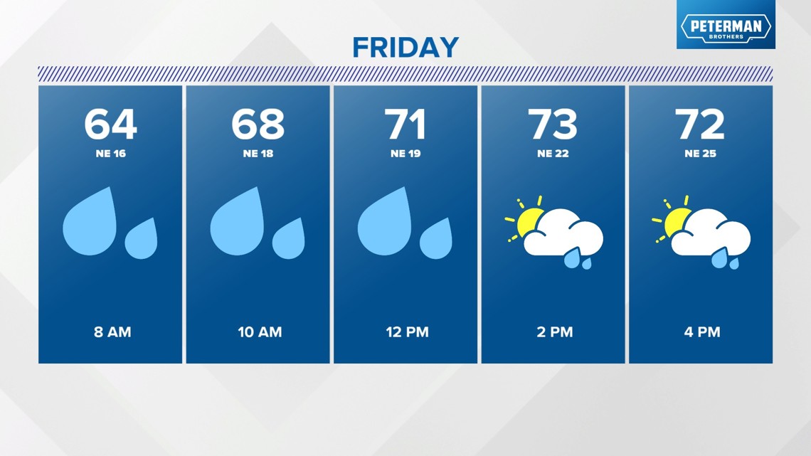
Take advantage of the dry time, because more widespread rain is expected later Friday.

The rain chances will linger into the weekend.
Hurricane Helene will make landfall between Pensacola and Tampa Thursday evening. Helene is expected to rapidly intensify into a major hurricane with winds of at least 110 mph.
After landfall, the storm will move quickly north and impact central Indiana.
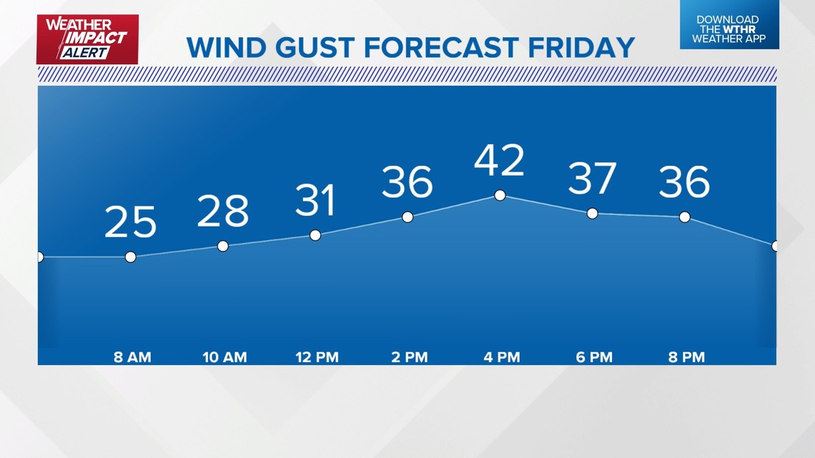
We want to alert you ahead of time so you can prepare now for wind gusts 30-50 mph or more and areas of heavy rain. Winds this strong may cause power outages. Be thinking now about keeping your cell phone with a full charge on Friday. You have time now to bring in patio furniture, outdoor toys and other items that might fly around with the strong winds.

This system moves quickly our way, but then stalls across the Midwest. This will mean additional rain chances on Saturday and Sunday.
Be sure to check radar before outdoor plans and check with the 13 Weather Team for updates.