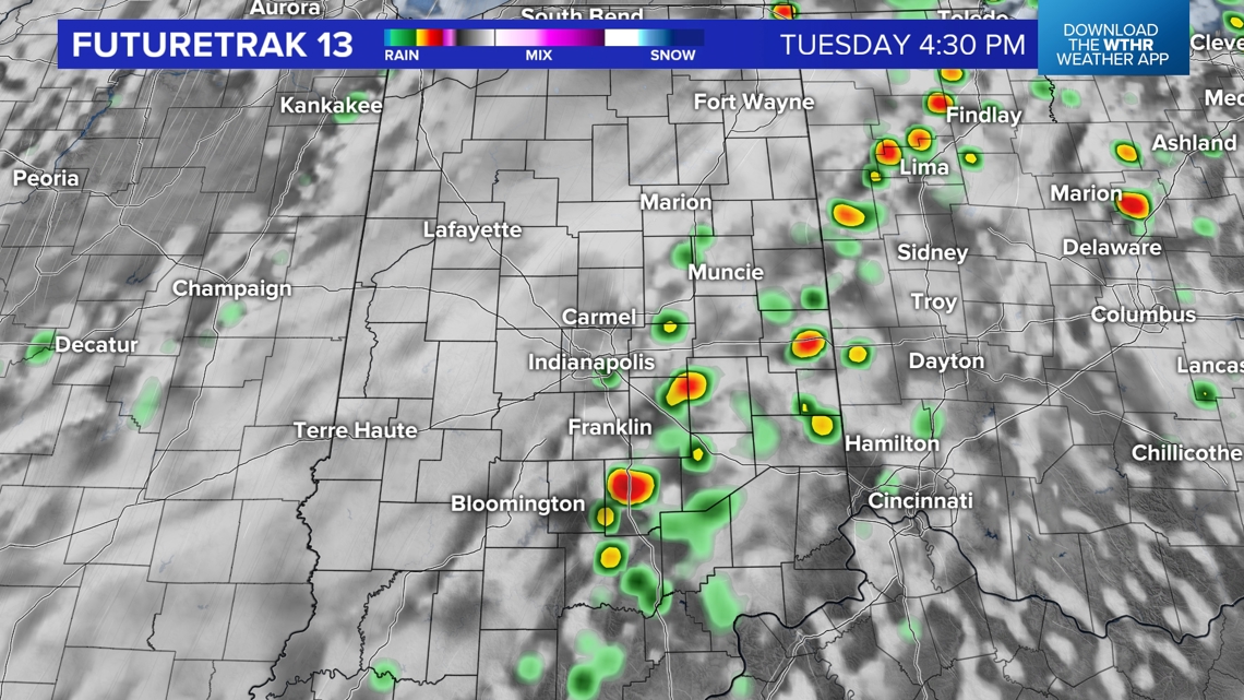
INDIANAPOLIS — It's an interesting weather day in central Indiana that began with welcomed rainfall near and west of I-65. That included downtown Indianapolis this morning, where a storm cluster brought decent rain within the heaviest axis that stretched from Elletsville, Martinsville, to Beech Grove. However, those east of 465 into Hancock County missed out.
The disparity in rain, and residual cloud cover, create a setup where far eastern-southeastern Indiana and far northwestern Indiana have a greater chance of seeing heavy pop-up storms this afternoon due to hotter, more unstable air.

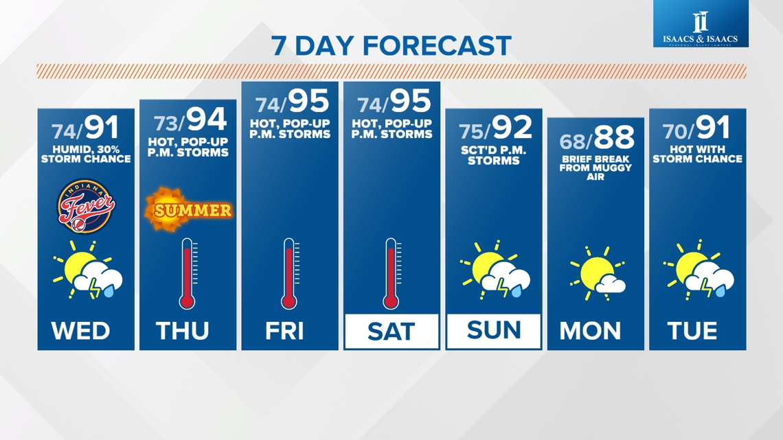
But everyone should be monitoring radar if you have outdoor plans. Though those places will be hotter, we're all in the same muggy airmass. But it will either be muggy in the 80s or muggy in the 90s — pick your poison.
Any storms that develop should diminish after sunset. Additional cloud cover Wednesday morning thins as the day progresses to allow for most places to return to the 90s.


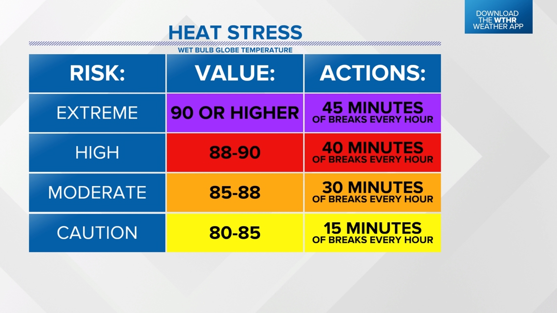
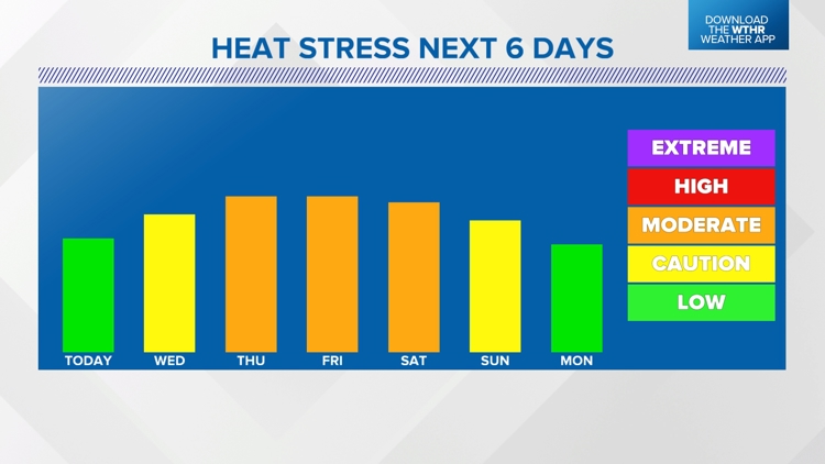
Less cloud cover moving forward means hotter temperatures and a greater threat for heat issues as the Heat Stress Index (a combination of dewpoint, temperature, sunshine, time of day) climbs into the moderate range Thursday into Saturday. That's when you should be taking half-hour breaks for every hour you're outside.
The next best chance of storm clusters after today occurs on Sunday with the arrival of a frontal system. That boundary brings brief relief in the mugginess on Monday, but we're back to hot and humid next Tuesday.