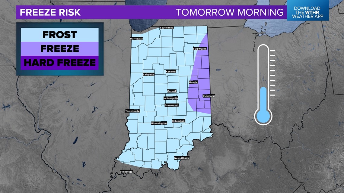
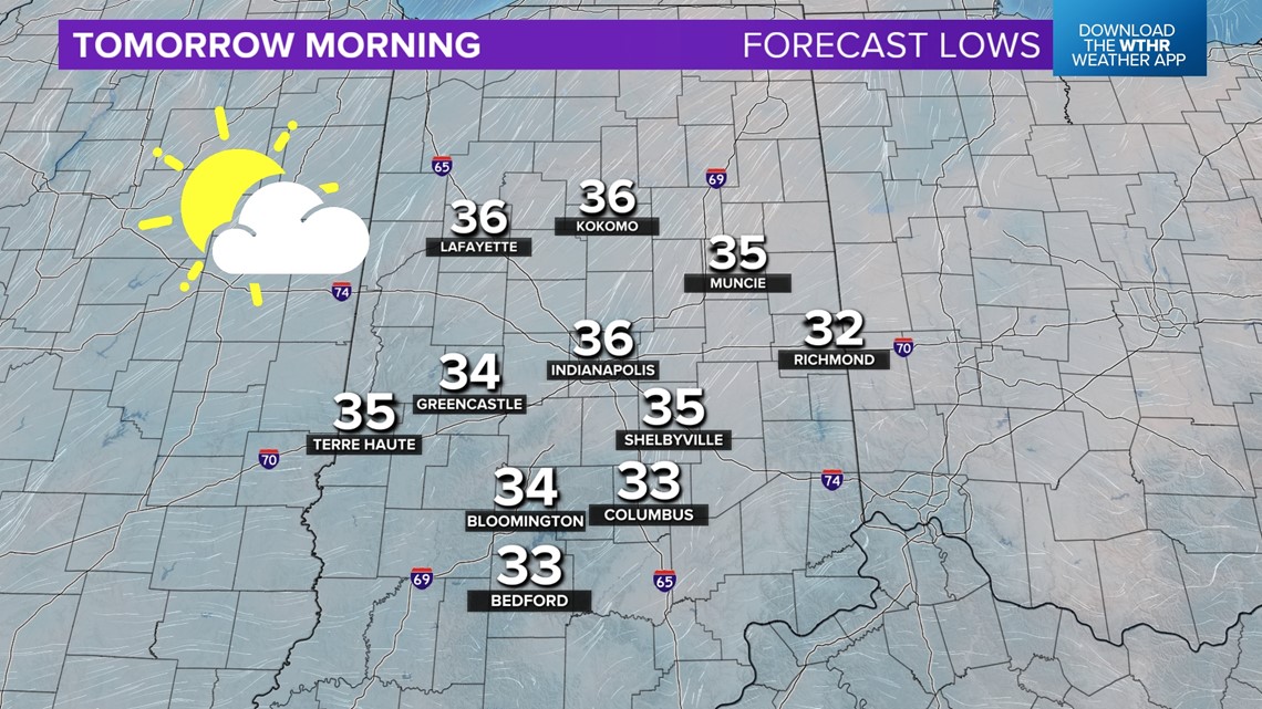
INDIANA, USA — UPDATE: Every county in Indiana is under a frost advisory. After midnight watch for some frost development into Monday morning as temperatures drop into the 30s again. The coldest air is slowly shifting south and east.
Tap HERE to track temperatures and storms with our interactive radar maps.
Why a frost now? The coldest mornings are usually roughly two days after the last storm system. Once the air quiets down enough, the air can cool off faster at night, plus you usually have some of the cooler air after the front already in place.
Tap HERE to see when the average last freeze is for your Indiana county.
Tonight
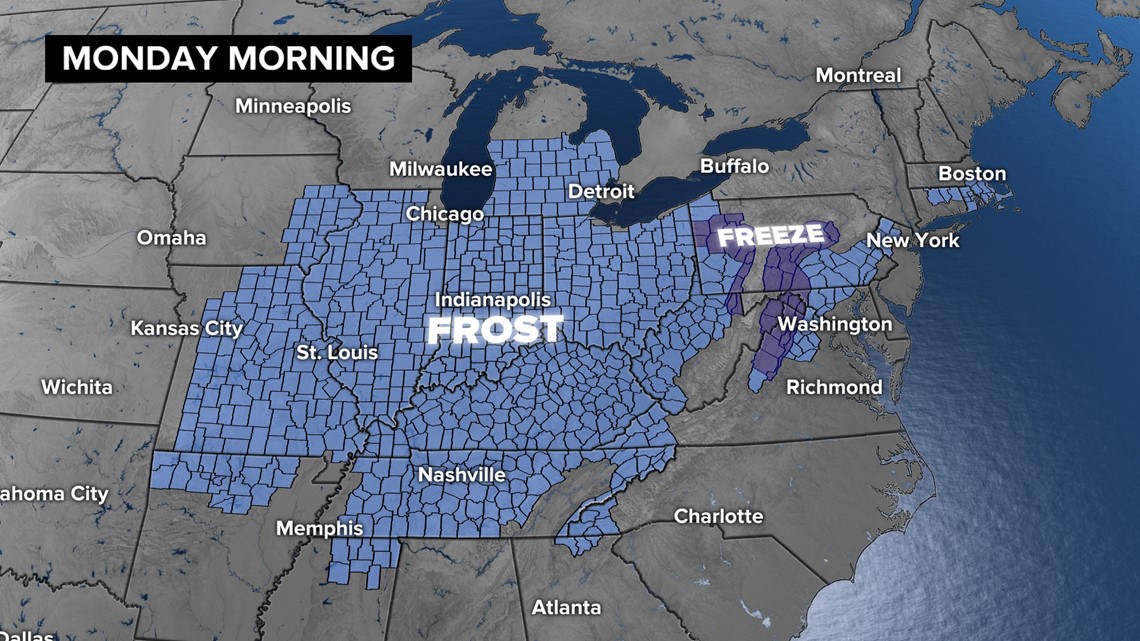
A mix of frost and freeze alerts have been activated across the Midwest and southern Great Lakes. Most likely, Indiana is under frost alerts as well. The southern extent for the advisories has been extended very far south. However that does mean everyone south of the Ohio River will get a frost. It is mainly for low-lying areas and valleys in the Ohio River Valley region. That's where temperatures may slide into low and mid 30s tonight.


What are the frost chances across Indiana for Monday morning?
The coldest air for the night will likely drift south and east across Indiana compared to Sunday morning. Much of the state has the chance for frost. There is a chance for a patchy freeze in extreme eastern Indiana.


Even if forecasted temperatures are technically above freezing, the ground can get colder, as well as plants near the ground. Usually the air right next to the ground is three to four degrees colder than air temperature observations across the state.


After the cool start, a south wind will start to return 5-10 MPH throughout the afternoon. That will help highs return to some low and mid 60s later in the day.
—13News Meteorologist Matt Standridge

